

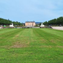
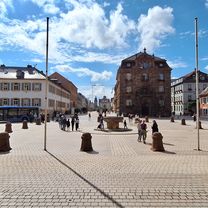
Heidelberg
A cycling route starting in Otterstadt, Rhineland-Palatinate, Germany.
Overview
About this route
super
- -:--
- Duration
- 79.7 km
- Distance
- 383 m
- Ascent
- 383 m
- Descent
- ---
- Avg. speed
- ---
- Max. altitude

Route quality
Waytypes & surfaces along the route
Waytypes
Path
24.7 km
(31 %)
Quiet road
16.9 km
(21 %)
Surfaces
Paved
69.3 km
(87 %)
Unpaved
4.7 km
(6 %)
Asphalt
57.8 km
(73 %)
Paving stones
6.7 km
(8 %)
Continue with Bikemap
Use, edit, or download this cycling route
You would like to ride Heidelberg or customize it for your own trip? Here is what you can do with this Bikemap route:
Free features
- Save this route as favorite or in collections
- Copy & plan your own version of this route
- Sync your route with Garmin or Wahoo
Premium features
Free trial for 3 days, or one-time payment. More about Bikemap Premium.
- Navigate this route on iOS & Android
- Export a GPX / KML file of this route
- Create your custom printout (try it for free)
- Download this route for offline navigation
Discover more Premium features.
Get Bikemap PremiumFrom our community
Other popular routes starting in Otterstadt
 Gerade Fahrt in Speyer
- Distance
- 41 km
- Ascent
- 26 m
- Descent
- 12 m
- Location
- Otterstadt, Rhineland-Palatinate, Germany
 Camping Kollersee nach Schwetzingen Schlossgarten
- Distance
- 8.7 km
- Ascent
- 20 m
- Descent
- 66 m
- Location
- Otterstadt, Rhineland-Palatinate, Germany
 Rettich-Rhein-Tour
- Distance
- 36.1 km
- Ascent
- 56 m
- Descent
- 59 m
- Location
- Otterstadt, Rhineland-Palatinate, Germany
 Camping Kollersee nach Camping Kollersee
- Distance
- 19.9 km
- Ascent
- 39 m
- Descent
- 82 m
- Location
- Otterstadt, Rhineland-Palatinate, Germany
 Stickelspitzer-Kraftwerks-Rundfahrt
- Distance
- 20.5 km
- Ascent
- 50 m
- Descent
- 54 m
- Location
- Otterstadt, Rhineland-Palatinate, Germany
 Heidelberg
- Distance
- 79.7 km
- Ascent
- 383 m
- Descent
- 383 m
- Location
- Otterstadt, Rhineland-Palatinate, Germany
 From camping CWO to wildcamp spot Jockgrim
- Distance
- 46.4 km
- Ascent
- 72 m
- Descent
- 60 m
- Location
- Otterstadt, Rhineland-Palatinate, Germany
 Umleitung_Otterstadt-Waldsee
- Distance
- 12.2 km
- Ascent
- 35 m
- Descent
- 32 m
- Location
- Otterstadt, Rhineland-Palatinate, Germany
Open it in the app