

Mangfalltal
A cycling route starting in Tuntenhausen, Bavaria, Germany.
Overview
About this route
Gefahren am 03.09.2016
- -:--
- Duration
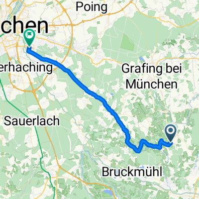
- 52.9 km
- Distance
- 189 m
- Ascent
- 194 m
- Descent
- ---
- Avg. speed
- ---
- Avg. speed

Route quality
Waytypes & surfaces along the route
Waytypes
Path
19.9 km
(38 %)
Quiet road
14.9 km
(28 %)
Surfaces
Paved
27.7 km
(52 %)
Unpaved
21.4 km
(41 %)
Asphalt
27.2 km
(51 %)
Loose gravel
11.6 km
(22 %)
Continue with Bikemap
Use, edit, or download this cycling route
You would like to ride Mangfalltal or customize it for your own trip? Here is what you can do with this Bikemap route:
Free features
- Save this route as favorite or in collections
- Copy & plan your own version of this route
- Sync your route with Garmin or Wahoo
Premium features
Free trial for 3 days, or one-time payment. More about Bikemap Premium.
- Navigate this route on iOS & Android
- Export a GPX / KML file of this route
- Create your custom printout (try it for free)
- Download this route for offline navigation
Discover more Premium features.
Get Bikemap PremiumFrom our community
Other popular routes starting in Tuntenhausen
 20.06.11 Frohnleichnamstour
- Distance
- 49.6 km
- Ascent
- 314 m
- Descent
- 303 m
- Location
- Tuntenhausen, Bavaria, Germany
 Von Tuntenhausen nach München/Neuperlach
- Distance
- 42.5 km
- Ascent
- 363 m
- Descent
- 321 m
- Location
- Tuntenhausen, Bavaria, Germany
 Hofberg-Haus-Runde
- Distance
- 15.6 km
- Ascent
- 99 m
- Descent
- 99 m
- Location
- Tuntenhausen, Bavaria, Germany
 Route von Antersberg 500, Tuntenhausen
- Distance
- 39.9 km
- Ascent
- 275 m
- Descent
- 237 m
- Location
- Tuntenhausen, Bavaria, Germany
 Mangfalltal
- Distance
- 52.9 km
- Ascent
- 189 m
- Descent
- 194 m
- Location
- Tuntenhausen, Bavaria, Germany
 Niedergartenweg 14, Tuntenhausen nach Emling 1, Tuntenhausen
- Distance
- 26.1 km
- Ascent
- 68 m
- Descent
- 51 m
- Location
- Tuntenhausen, Bavaria, Germany
 Arbeit über Glonn und Siegertsbrunn nach Neuperlach
- Distance
- 41.2 km
- Ascent
- 280 m
- Descent
- 230 m
- Location
- Tuntenhausen, Bavaria, Germany
 Tuntenhausen Wolfersberg Neuperlach
- Distance
- 41.8 km
- Ascent
- 355 m
- Descent
- 300 m
- Location
- Tuntenhausen, Bavaria, Germany
Open it in the app