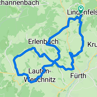
Lindenfels - Tromm - Lindenfels - Singletrails
A cycling route starting in Lindenfels, Hesse, Germany.
Overview
About this route
Eine Tour mit den besten und längsten Singnletrails der Region für anspruchsvolle Biker.
Hinweis: Am Irenen Turm wird bei der Abfahrt die ausgewiesene Umleitungsstrecke empfohlen.
Start + Ziel: Lindenfels, Parkplatz Kappstraße
- -:--
- Duration
- 31.2 km
- Distance
- 691 m
- Ascent
- 693 m
- Descent
- ---
- Avg. speed
- ---
- Avg. speed
Continue with Bikemap
Use, edit, or download this cycling route
You would like to ride Lindenfels - Tromm - Lindenfels - Singletrails or customize it for your own trip? Here is what you can do with this Bikemap route:
Free features
- Save this route as favorite or in collections
- Copy & plan your own version of this route
- Sync your route with Garmin or Wahoo
Premium features
Free trial for 3 days, or one-time payment. More about Bikemap Premium.
- Navigate this route on iOS & Android
- Export a GPX / KML file of this route
- Create your custom printout (try it for free)
- Download this route for offline navigation
Discover more Premium features.
Get Bikemap PremiumFrom our community
Other popular routes starting in Lindenfels
- Winkel - Fürth - Reichelsheim - Fränkisch Crumbach - Groß Bieberau - Ober Ramstadt - DA City
- Distance
- 48 km
- Ascent
- 320 m
- Descent
- 383 m
- Location
- Lindenfels, Hesse, Germany
- Lindenfels - Tromm - Lindenfels - Singletrails
- Distance
- 31.2 km
- Ascent
- 691 m
- Descent
- 693 m
- Location
- Lindenfels, Hesse, Germany
- Lindenfels - schöne Aussichten
- Distance
- 12.4 km
- Ascent
- 467 m
- Descent
- 467 m
- Location
- Lindenfels, Hesse, Germany
- Rund um Lindenfels
- Distance
- 25.4 km
- Ascent
- 648 m
- Descent
- 648 m
- Location
- Lindenfels, Hesse, Germany
- Lindenfels - Talfahrt in offenes Wiesen gelände
- Distance
- 19.7 km
- Ascent
- 462 m
- Descent
- 465 m
- Location
- Lindenfels, Hesse, Germany
- Lindenfels-Knodener Kopf-Reichenbach-Hohenstein-Lindenfels
- Distance
- 29.1 km
- Ascent
- 668 m
- Descent
- 667 m
- Location
- Lindenfels, Hesse, Germany
- Lindenfels - tolle Fernsicht ins Weschnitztal und Gersprenztal
- Distance
- 9.4 km
- Ascent
- 375 m
- Descent
- 373 m
- Location
- Lindenfels, Hesse, Germany
- Lindenfels - Seidenbuch - Kolmbach - Lindenfels
- Distance
- 18.7 km
- Ascent
- 483 m
- Descent
- 605 m
- Location
- Lindenfels, Hesse, Germany
Open it in the app