

Blidsee Trail and Barabara Steig Trail
A cycling route starting in Biberwier, Tyrol, Austria.
Overview
About this route
really nice Bike Tour using ski lifts. Hence only little uphill paddling.
The trails are not easy but doable with some experience. Really nice views!
First you take the Grubigstein Bahn section 1 and 2. Then you go down to Blidsee. Then you cross the valles. And then you take another 2 lifts. And enter the final trail. This the complete track incl. the lifts.
The tour starts in Biberwir. There you park the car on the parking of the church
- -:--
- Duration
- 27.5 km
- Distance
- 1,711 m
- Ascent
- 1,711 m
- Descent
- ---
- Avg. speed
- ---
- Max. altitude

Continue with Bikemap
Use, edit, or download this cycling route
You would like to ride Blidsee Trail and Barabara Steig Trail or customize it for your own trip? Here is what you can do with this Bikemap route:
Free features
- Save this route as favorite or in collections
- Copy & plan your own version of this route
- Sync your route with Garmin or Wahoo
Premium features
Free trial for 3 days, or one-time payment. More about Bikemap Premium.
- Navigate this route on iOS & Android
- Export a GPX / KML file of this route
- Create your custom printout (try it for free)
- Download this route for offline navigation
Discover more Premium features.
Get Bikemap PremiumFrom our community
Other popular routes starting in Biberwier
 8. Etappe: Biberwier - Zams
- Distance
- 59.3 km
- Ascent
- 1,220 m
- Descent
- 1,452 m
- Location
- Biberwier, Tyrol, Austria
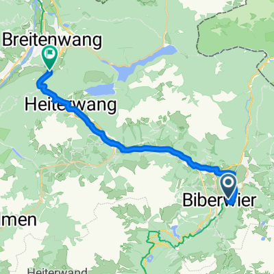 Biberwier - Breitenwang
- Distance
- 22.7 km
- Ascent
- 435 m
- Descent
- 490 m
- Location
- Biberwier, Tyrol, Austria
 Ö5Biberw-Garmisch-Ahornbogen (Eng)
- Distance
- 89.6 km
- Ascent
- 1,082 m
- Descent
- 875 m
- Location
- Biberwier, Tyrol, Austria
 L71 64, Biberwier nach Malserstraße 31, Landeck
- Distance
- 54.4 km
- Ascent
- 651 m
- Descent
- 852 m
- Location
- Biberwier, Tyrol, Austria
 OETZ 08 Biberwier
- Distance
- 21.1 km
- Ascent
- 658 m
- Descent
- 649 m
- Location
- Biberwier, Tyrol, Austria
 Biberwier - Murnau am Staffelsee
- Distance
- 54.2 km
- Ascent
- 256 m
- Descent
- 570 m
- Location
- Biberwier, Tyrol, Austria
 Mühlsteig, Biberwier nach Sameranger I, Nassereith
- Distance
- 13.3 km
- Ascent
- 356 m
- Descent
- 388 m
- Location
- Biberwier, Tyrol, Austria
 Von Biberwier bis Zirl
- Distance
- 77.5 km
- Ascent
- 1,166 m
- Descent
- 1,533 m
- Location
- Biberwier, Tyrol, Austria
Open it in the app