

Lago Thures
A cycling route starting in Le Monêtier-les-Bains, Provence-Alpes-Côte d'Azur Region, France.
Overview
About this route
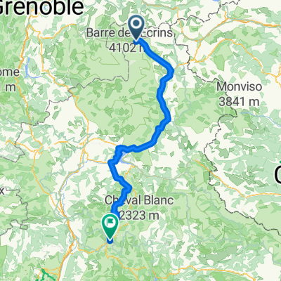
You park near the margaro and then continue to the 2 lakes, the first being the Thures lake.
- -:--
- Duration
- 4.4 km
- Distance
- 587 m
- Ascent
- 33 m
- Descent
- ---
- Avg. speed
- ---
- Max. altitude

Continue with Bikemap
Use, edit, or download this cycling route
You would like to ride Lago Thures or customize it for your own trip? Here is what you can do with this Bikemap route:
Free features
- Save this route as favorite or in collections
- Copy & plan your own version of this route
- Sync your route with Garmin or Wahoo
Premium features
Free trial for 3 days, or one-time payment. More about Bikemap Premium.
- Navigate this route on iOS & Android
- Export a GPX / KML file of this route
- Create your custom printout (try it for free)
- Download this route for offline navigation
Discover more Premium features.
Get Bikemap PremiumFrom our community
Other popular routes starting in Le Monêtier-les-Bains
 Monastier Galibier Rochilles Nevache Briançon
- Distance
- 87.4 km
- Ascent
- 1,772 m
- Descent
- 1,809 m
- Location
- Le Monêtier-les-Bains, Provence-Alpes-Côte d'Azur Region, France
 RdGA - 'rustdag' Col du Lautaret - L'Alpe d'Huez - Col du Lautaret
- Distance
- 100.7 km
- Ascent
- 2,371 m
- Descent
- 2,371 m
- Location
- Le Monêtier-les-Bains, Provence-Alpes-Côte d'Azur Region, France
 Etape 6b - Route grands Alpes
- Distance
- 8 km
- Ascent
- 0 m
- Descent
- 126 m
- Location
- Le Monêtier-les-Bains, Provence-Alpes-Côte d'Azur Region, France
 ラルプへの道
- Distance
- 39.2 km
- Ascent
- 455 m
- Descent
- 1,797 m
- Location
- Le Monêtier-les-Bains, Provence-Alpes-Côte d'Azur Region, France
 27-6: Col du Galibier
- Distance
- 52.9 km
- Ascent
- 1,791 m
- Descent
- 1,781 m
- Location
- Le Monêtier-les-Bains, Provence-Alpes-Côte d'Azur Region, France
 #8 Col du Lautaret - Digne
- Distance
- 174.7 km
- Ascent
- 4,436 m
- Descent
- 5,901 m
- Location
- Le Monêtier-les-Bains, Provence-Alpes-Côte d'Azur Region, France
 Col du Lautaret, Col du Galibier in Col du Telegraphe
- Distance
- 89.6 km
- Ascent
- 2,422 m
- Descent
- 2,421 m
- Location
- Le Monêtier-les-Bains, Provence-Alpes-Côte d'Azur Region, France
 4- alpe d'huez
- Distance
- 48.6 km
- Ascent
- 2,366 m
- Descent
- 2,415 m
- Location
- Le Monêtier-les-Bains, Provence-Alpes-Côte d'Azur Region, France
Open it in the app