

TransErz 150km
A cycling route starting in Tharandt, Saxony, Germany.
Overview
About this route
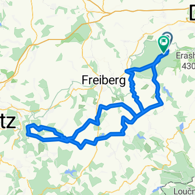
Tharandter Wald - Frauenstein - Erzgebirgskamm - Schmiedeberg - Gläshütte - Altenberg - Dipps - Tharandter Wald
- -:--
- Duration
- 146.4 km
- Distance
- 1,388 m
- Ascent
- 1,388 m
- Descent
- ---
- Avg. speed
- ---
- Max. altitude
Route quality
Waytypes & surfaces along the route
Waytypes
Busy road
100.8 km
(69 %)
Road
27.6 km
(19 %)
Surfaces
Paved
124.8 km
(85 %)
Unpaved
2.8 km
(2 %)
Asphalt
121.4 km
(83 %)
Paving stones
2.9 km
(2 %)
Continue with Bikemap
Use, edit, or download this cycling route
You would like to ride TransErz 150km or customize it for your own trip? Here is what you can do with this Bikemap route:
Free features
- Save this route as favorite or in collections
- Copy & plan your own version of this route
- Split it into stages to create a multi-day tour
- Sync your route with Garmin or Wahoo
Premium features
Free trial for 3 days, or one-time payment. More about Bikemap Premium.
- Navigate this route on iOS & Android
- Export a GPX / KML file of this route
- Create your custom printout (try it for free)
- Download this route for offline navigation
Discover more Premium features.
Get Bikemap PremiumFrom our community
Other popular routes starting in Tharandt
 Tharandter Wald
- Distance
- 47.3 km
- Ascent
- 654 m
- Descent
- 637 m
- Location
- Tharandt, Saxony, Germany
 Spritztour nach Meißen
- Distance
- 73 km
- Ascent
- 270 m
- Descent
- 270 m
- Location
- Tharandt, Saxony, Germany
 sonntagswanderung
- Distance
- 14.2 km
- Ascent
- 324 m
- Descent
- 323 m
- Location
- Tharandt, Saxony, Germany
 RR 27 km - Tharandt
- Distance
- 25.7 km
- Ascent
- 445 m
- Descent
- 456 m
- Location
- Tharandt, Saxony, Germany
 Somsdorf-Altenberg-Somsdorf
- Distance
- 73.2 km
- Ascent
- 799 m
- Descent
- 803 m
- Location
- Tharandt, Saxony, Germany
 Mittelpunkt Sachsen
- Distance
- 37.5 km
- Ascent
- 433 m
- Descent
- 433 m
- Location
- Tharandt, Saxony, Germany
 Kleine Herrenrunde
- Distance
- 28.9 km
- Ascent
- 311 m
- Descent
- 376 m
- Location
- Tharandt, Saxony, Germany
 Hartha - Augstusburg - Hartha RTF
- Distance
- 125.4 km
- Ascent
- 1,429 m
- Descent
- 1,347 m
- Location
- Tharandt, Saxony, Germany
Open it in the app