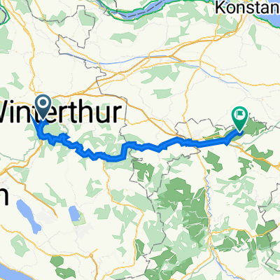
Husemersee
A cycling route starting in Stadt Winterthur (Kreis 1) / Tössfeld, Canton of Zurich, Switzerland.
Overview
About this route
- -:--
- Duration
- 36.7 km
- Distance
- 325 m
- Ascent
- 324 m
- Descent
- ---
- Avg. speed
- ---
- Avg. speed
Route photos
Route quality
Waytypes & surfaces along the route
Waytypes
Pedestrian area
14.5 km
(40 %)
Quiet road
6.1 km
(17 %)
Surfaces
Paved
32.4 km
(88 %)
Unpaved
3.9 km
(11 %)
Asphalt
32.1 km
(87 %)
Pebblestone
2.2 km
(6 %)
Continue with Bikemap
Use, edit, or download this cycling route
You would like to ride Husemersee or customize it for your own trip? Here is what you can do with this Bikemap route:
Free features
- Save this route as favorite or in collections
- Copy & plan your own version of this route
- Sync your route with Garmin or Wahoo
Premium features
Free trial for 3 days, or one-time payment. More about Bikemap Premium.
- Navigate this route on iOS & Android
- Export a GPX / KML file of this route
- Create your custom printout (try it for free)
- Download this route for offline navigation
Discover more Premium features.
Get Bikemap PremiumFrom our community
Other popular routes starting in Stadt Winterthur (Kreis 1) / Tössfeld
- Winterthur süd
- Distance
- 33 km
- Ascent
- 376 m
- Descent
- 379 m
- Location
- Stadt Winterthur (Kreis 1) / Tössfeld, Canton of Zurich, Switzerland
- An der Thur
- Distance
- 36.4 km
- Ascent
- 200 m
- Descent
- 200 m
- Location
- Stadt Winterthur (Kreis 1) / Tössfeld, Canton of Zurich, Switzerland
- Steig-Gerlisberg-Sunnebuel
- Distance
- 28.9 km
- Ascent
- 426 m
- Descent
- 424 m
- Location
- Stadt Winterthur (Kreis 1) / Tössfeld, Canton of Zurich, Switzerland
- Husemersee
- Distance
- 36.7 km
- Ascent
- 325 m
- Descent
- 324 m
- Location
- Stadt Winterthur (Kreis 1) / Tössfeld, Canton of Zurich, Switzerland
- Sonntagsrunde
- Distance
- 26.2 km
- Ascent
- 159 m
- Descent
- 159 m
- Location
- Stadt Winterthur (Kreis 1) / Tössfeld, Canton of Zurich, Switzerland
- Winterthur Seelmatten Elgg Winterthur
- Distance
- 54.1 km
- Ascent
- 425 m
- Descent
- 425 m
- Location
- Stadt Winterthur (Kreis 1) / Tössfeld, Canton of Zurich, Switzerland
- Winterthur Zürich
- Distance
- 27 km
- Ascent
- 299 m
- Descent
- 295 m
- Location
- Stadt Winterthur (Kreis 1) / Tössfeld, Canton of Zurich, Switzerland
- Stein am Reihn
- Distance
- 60.6 km
- Ascent
- 610 m
- Descent
- 610 m
- Location
- Stadt Winterthur (Kreis 1) / Tössfeld, Canton of Zurich, Switzerland