

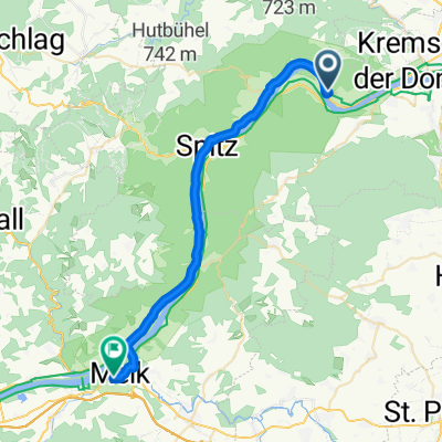
20160619_124925.gpx
A cycling route starting in Dürnstein, Lower Austria, Austria.
Overview
About this route
TEASI track
- -:--
- Duration
- 18.7 km
- Distance
- 88 m
- Ascent
- 243 m
- Descent
- ---
- Avg. speed
- ---
- Max. altitude

Route quality
Waytypes & surfaces along the route
Waytypes
Road
6.2 km
(33 %)
Quiet road
5.6 km
(30 %)
Surfaces
Paved
18.3 km
(98 %)
Asphalt
18.3 km
(98 %)
Undefined
0.4 km
(2 %)
Route highlights
Points of interest along the route
Point of interest after 0 km
Stadtzentrum
Point of interest after 7.5 km
Stadtzentrum
Point of interest after 12.3 km
Stadtzentrum
Point of interest after 18.7 km
Stadtzentrum
Continue with Bikemap
Use, edit, or download this cycling route
You would like to ride 20160619_124925.gpx or customize it for your own trip? Here is what you can do with this Bikemap route:
Free features
- Save this route as favorite or in collections
- Copy & plan your own version of this route
- Sync your route with Garmin or Wahoo
Premium features
Free trial for 3 days, or one-time payment. More about Bikemap Premium.
- Navigate this route on iOS & Android
- Export a GPX / KML file of this route
- Create your custom printout (try it for free)
- Download this route for offline navigation
Discover more Premium features.
Get Bikemap PremiumFrom our community
Other popular routes starting in Dürnstein
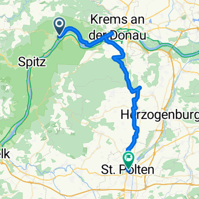
 3, Dürnstein - Kremser Straße, Klein-Pöchlarn
- Distance
- 47.9 km
- Ascent
- 270 m
- Descent
- 249 m
- Location
- Dürnstein, Lower Austria, Austria
 Ausflug nach Schloß Grafenegg
- Distance
- 69 km
- Ascent
- 115 m
- Descent
- 114 m
- Location
- Dürnstein, Lower Austria, Austria
 Dürnstein nach Ottenschlag
- Distance
- 31.4 km
- Ascent
- 846 m
- Descent
- 181 m
- Location
- Dürnstein, Lower Austria, Austria
 Unbenannte Route
- Distance
- 31.7 km
- Ascent
- 222 m
- Descent
- 216 m
- Location
- Dürnstein, Lower Austria, Austria
 Weissenkirchen nach Wiener Straße 16-18
- Distance
- 44 km
- Ascent
- 189 m
- Descent
- 122 m
- Location
- Dürnstein, Lower Austria, Austria
 20160619_124925.gpx
- Distance
- 18.7 km
- Ascent
- 88 m
- Descent
- 243 m
- Location
- Dürnstein, Lower Austria, Austria
 Entspannende Route in Krems an der Donau part III
- Distance
- 7.7 km
- Ascent
- 73 m
- Descent
- 91 m
- Location
- Dürnstein, Lower Austria, Austria
 Rossatz to Tulln
- Distance
- 52.4 km
- Ascent
- 239 m
- Descent
- 263 m
- Location
- Dürnstein, Lower Austria, Austria
Open it in the app