

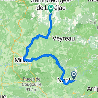
millau larzac viala de pas de jaux
A cycling route starting in La Cavalerie, Occitanie, France.
Overview
About this route
- -:--
- Duration
- 75.3 km
- Distance
- 920 m
- Ascent
- 1,183 m
- Descent
- ---
- Avg. speed
- ---
- Max. altitude
Route quality
Waytypes & surfaces along the route
Waytypes
Road
24.8 km
(33 %)
Track
24.8 km
(33 %)
Surfaces
Paved
38.4 km
(51 %)
Unpaved
10.5 km
(14 %)
Asphalt
36.9 km
(49 %)
Gravel
9.8 km
(13 %)
Route highlights
Points of interest along the route
Point of interest after 14 km
Continue with Bikemap
Use, edit, or download this cycling route
You would like to ride millau larzac viala de pas de jaux or customize it for your own trip? Here is what you can do with this Bikemap route:
Free features
- Save this route as favorite or in collections
- Copy & plan your own version of this route
- Sync your route with Garmin or Wahoo
Premium features
Free trial for 3 days, or one-time payment. More about Bikemap Premium.
- Navigate this route on iOS & Android
- Export a GPX / KML file of this route
- Create your custom printout (try it for free)
- Download this route for offline navigation
Discover more Premium features.
Get Bikemap PremiumFrom our community
Other popular routes starting in La Cavalerie
 Larzac Ascencion 2010- Jour 4
- Distance
- 49.1 km
- Ascent
- 774 m
- Descent
- 1,259 m
- Location
- La Cavalerie, Occitanie, France
 Larzac Ascencion 2010- Jour 2
- Distance
- 55.3 km
- Ascent
- 642 m
- Descent
- 641 m
- Location
- La Cavalerie, Occitanie, France
 2021 Cornus-Viala du Pas du Jaux
- Distance
- 17.8 km
- Ascent
- 212 m
- Descent
- 162 m
- Location
- La Cavalerie, Occitanie, France
 Larzac Ascencion 2010- Jour 3
- Distance
- 62.3 km
- Ascent
- 512 m
- Descent
- 503 m
- Location
- La Cavalerie, Occitanie, France
 Cevennen-Tour 2007 Tag 3
- Distance
- 69 km
- Ascent
- 1,691 m
- Descent
- 1,802 m
- Location
- La Cavalerie, Occitanie, France
 La Couvertoirade / Lunas
- Distance
- 54.8 km
- Ascent
- 1,265 m
- Descent
- 1,760 m
- Location
- La Cavalerie, Occitanie, France
 TMC7_St Jean du Bruel - Ceilhes Roqueredonde
- Distance
- 49 km
- Ascent
- 1,076 m
- Descent
- 1,150 m
- Location
- La Cavalerie, Occitanie, France
 J5: L'Hospitalet-du-Larzac-Solages
- Distance
- 81.3 km
- Ascent
- 458 m
- Descent
- 860 m
- Location
- La Cavalerie, Occitanie, France
Open it in the app