

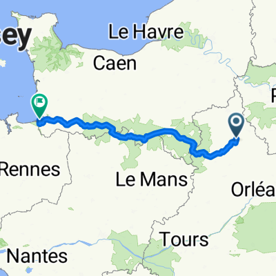
Chartes-Le Puy-en-Velay
A cycling route starting in Chartres, Centre-Val de Loire, France.
Overview
About this route
Vélo 2016
Chartres-Le Puy-en-Velay - 4 étapes
Quentin Clément Julien Nathan
Team Grosses cuisses
- -:--
- Duration
- 574.1 km
- Distance
- 1,877 m
- Ascent
- 2,208 m
- Descent
- ---
- Avg. speed
- ---
- Max. altitude

Route quality
Waytypes & surfaces along the route
Waytypes
Road
370.9 km
(65 %)
Busy road
91.8 km
(16 %)
Surfaces
Paved
162.9 km
(28 %)
Unpaved
4.8 km
(<1 %)
Asphalt
160.4 km
(28 %)
Ground
2.8 km
(<1 %)
Continue with Bikemap
Use, edit, or download this cycling route
You would like to ride Chartes-Le Puy-en-Velay or customize it for your own trip? Here is what you can do with this Bikemap route:
Free features
- Save this route as favorite or in collections
- Copy & plan your own version of this route
- Split it into stages to create a multi-day tour
- Sync your route with Garmin or Wahoo
Premium features
Free trial for 3 days, or one-time payment. More about Bikemap Premium.
- Navigate this route on iOS & Android
- Export a GPX / KML file of this route
- Create your custom printout (try it for free)
- Download this route for offline navigation
Discover more Premium features.
Get Bikemap PremiumFrom our community
Other popular routes starting in Chartres
 Comp-D10b-Chartr-S-J-Froid-80km
- Distance
- 79.5 km
- Ascent
- 230 m
- Descent
- 385 m
- Location
- Chartres, Centre-Val de Loire, France
 EU 17 _ Chartres - Chateaudun _ 67 km
- Distance
- 67.2 km
- Ascent
- 104 m
- Descent
- 145 m
- Location
- Chartres, Centre-Val de Loire, France
 chartres Erdeven owlcamp
- Distance
- 459.5 km
- Ascent
- 402 m
- Descent
- 541 m
- Location
- Chartres, Centre-Val de Loire, France
 chartres erdeven via le mans
- Distance
- 422.6 km
- Ascent
- 508 m
- Descent
- 634 m
- Location
- Chartres, Centre-Val de Loire, France
 Comp-D10-Chartr-Chateau-58km
- Distance
- 58.1 km
- Ascent
- 250 m
- Descent
- 266 m
- Location
- Chartres, Centre-Val de Loire, France
 Velocenie août 2025
- Distance
- 319.3 km
- Ascent
- 1,872 m
- Descent
- 2,023 m
- Location
- Chartres, Centre-Val de Loire, France
 Dag. 32 Chartres- Vibraye
- Distance
- 76.7 km
- Ascent
- 189 m
- Descent
- 232 m
- Location
- Chartres, Centre-Val de Loire, France
 D1 Chartres-Vasselay
- Distance
- 202.6 km
- Ascent
- 309 m
- Descent
- 277 m
- Location
- Chartres, Centre-Val de Loire, France
Open it in the app