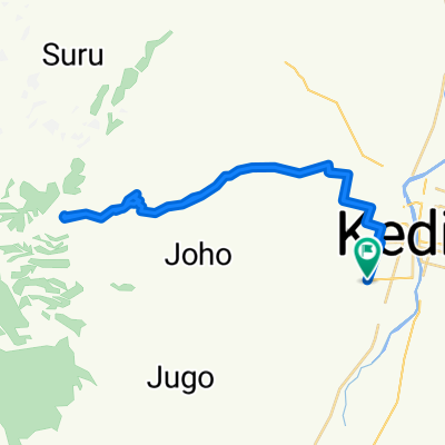
"Besuki - Beru - Kraton" Indosat MTB Adventure
A cycling route starting in Kediri, East Java, Indonesia.
Overview
About this route
Rute offroad bareng Indosat Cycling Community pada hari Minggu 20 Desember 2009.
Start dari wana wisata Besuki menyusuri hutan Pinus Lungur hingga ke tower Global TV. Kemudian menuju ke hutan Pinus Beru menyusuri single track menuju dusun Blimbing dan berakhir di dekat pabrik pengolahan getah karet Secang Sukosewu - Kraton.
Wisata Besuki - Start Lungur = 0,68 km
Start Lungur - Global TV = 1,6 km
Global TV - Beru Gate = 2,2 km
Beru Gate - Jeruk Blimbing = 9,5 km<br />Blimbing - Secang Sukosewu = 19,4 km
===========================
Kediri, 20 Desember 2009
by MTB Unlimited
- -:--
- Duration
- 56 km
- Distance
- 1,114 m
- Ascent
- 1,125 m
- Descent
- ---
- Avg. speed
- ---
- Max. altitude
Continue with Bikemap
Use, edit, or download this cycling route
You would like to ride "Besuki - Beru - Kraton" Indosat MTB Adventure or customize it for your own trip? Here is what you can do with this Bikemap route:
Free features
- Save this route as favorite or in collections
- Copy & plan your own version of this route
- Sync your route with Garmin or Wahoo
Premium features
Free trial for 3 days, or one-time payment. More about Bikemap Premium.
- Navigate this route on iOS & Android
- Export a GPX / KML file of this route
- Create your custom printout (try it for free)
- Download this route for offline navigation
Discover more Premium features.
Get Bikemap PremiumFrom our community
Other popular routes starting in Kediri
- Trek Kandang Ayam Jalur Panjang
- Distance
- 76.4 km
- Ascent
- 551 m
- Descent
- 1,031 m
- Location
- Kediri, East Java, Indonesia
- "Besuki - Beru - Kraton" Indosat MTB Adventure
- Distance
- 56 km
- Ascent
- 1,114 m
- Descent
- 1,125 m
- Location
- Kediri, East Java, Indonesia
- Jalan Sultan Agung VI 120, Kecamatan Kota Kediri to Jalan GOR Jayabaya 26, Kecamatan Mojoroto
- Distance
- 6.3 km
- Ascent
- 19 m
- Descent
- 17 m
- Location
- Kediri, East Java, Indonesia
- Jalur Kandang Ayam (Reguler) - Kediri
- Distance
- 21.9 km
- Ascent
- 303 m
- Descent
- 317 m
- Location
- Kediri, East Java, Indonesia
- Ngleyangan Waterfall
- Distance
- 51.9 km
- Ascent
- 1,027 m
- Descent
- 1,028 m
- Location
- Kediri, East Java, Indonesia
- Parijotho Waterfall
- Distance
- 26.7 km
- Ascent
- 734 m
- Descent
- 29 m
- Location
- Kediri, East Java, Indonesia
- Jalur Keniten
- Distance
- 29.2 km
- Ascent
- 476 m
- Descent
- 494 m
- Location
- Kediri, East Java, Indonesia
- Ngleyangan Waterfall All Akses
- Distance
- 115.7 km
- Ascent
- 1,343 m
- Descent
- 1,345 m
- Location
- Kediri, East Java, Indonesia
Open it in the app