

Rundkurs Rhein-Herne-Kanal - Haard
A cycling route starting in Gelsenkirchen, North Rhine-Westphalia, Germany.
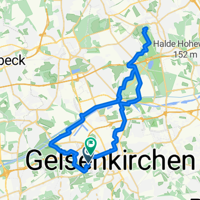
Overview
About this route
Start from Erzbahntrasse, Recklinghausen to Haard, Haltener Lake, gravel pits
Borkenberge airfield, Hullern Reservoir, Lüdinghausen from here along the canal
Dortmund-Ems, Rhein-Herne
home
- -:--
- Duration
- 112.5 km
- Distance
- 324 m
- Ascent
- 325 m
- Descent
- ---
- Avg. speed
- ---
- Max. altitude
Route highlights
Points of interest along the route
Point of interest after 13.3 km
Treffpunkt mit Wolfgang

Photo after 21.9 km
Feuerwachturm Kiebitzberg
Point of interest after 22.2 km
Bergwerk Haard

Photo after 30.7 km
Halterner Stausee
Point of interest after 45.6 km
Flugplatz Borkenberge
Point of interest after 71.7 km
Dortmund-Ems-Kanal
Point of interest after 76 km
Alte Fahrt, Dortmund-Ems-Kanal

Photo after 81.8 km
Lippe

Photo after 83.6 km
Wesel-Datteln-Kanal
Point of interest after 86.7 km
Wesel-Datteln-Kanal

Photo after 89 km
Sperrwerk

Point of interest after 94.9 km
Biergarten
Point of interest after 95.2 km
Emscher

Photo after 108.7 km
Aufbau Cranger-Kirmis
Continue with Bikemap
Use, edit, or download this cycling route
You would like to ride Rundkurs Rhein-Herne-Kanal - Haard or customize it for your own trip? Here is what you can do with this Bikemap route:
Free features
- Save this route as favorite or in collections
- Copy & plan your own version of this route
- Split it into stages to create a multi-day tour
- Sync your route with Garmin or Wahoo
Premium features
Free trial for 3 days, or one-time payment. More about Bikemap Premium.
- Navigate this route on iOS & Android
- Export a GPX / KML file of this route
- Create your custom printout (try it for free)
- Download this route for offline navigation
Discover more Premium features.
Get Bikemap PremiumFrom our community
Other popular routes starting in Gelsenkirchen
 Rund Um Gelsenkirchen Mit Halden
- Distance
- 32.6 km
- Ascent
- 93 m
- Descent
- 93 m
- Location
- Gelsenkirchen, North Rhine-Westphalia, Germany
 Einmal Kettwig und zurück
- Distance
- 64.2 km
- Ascent
- 497 m
- Descent
- 505 m
- Location
- Gelsenkirchen, North Rhine-Westphalia, Germany
 Route zu Schloss Herten Cafe
- Distance
- 32.2 km
- Ascent
- 135 m
- Descent
- 139 m
- Location
- Gelsenkirchen, North Rhine-Westphalia, Germany
 Herne-KönigLudwig-Datteln
- Distance
- 71.5 km
- Ascent
- 148 m
- Descent
- 144 m
- Location
- Gelsenkirchen, North Rhine-Westphalia, Germany
 Kleine Gelsenkirchen-Runde
- Distance
- 19.8 km
- Ascent
- 63 m
- Descent
- 63 m
- Location
- Gelsenkirchen, North Rhine-Westphalia, Germany
 Auf alten Zechenbahntrassen u.a Erzbahntrasse
- Distance
- 26.2 km
- Ascent
- 73 m
- Descent
- 72 m
- Location
- Gelsenkirchen, North Rhine-Westphalia, Germany
 Neues zur Zechenbahntrasse Blumenthal
- Distance
- 39 km
- Ascent
- 149 m
- Descent
- 149 m
- Location
- Gelsenkirchen, North Rhine-Westphalia, Germany
 Erzbahntrasse 1
- Distance
- 8.4 km
- Ascent
- 57 m
- Descent
- 17 m
- Location
- Gelsenkirchen, North Rhine-Westphalia, Germany
Open it in the app