

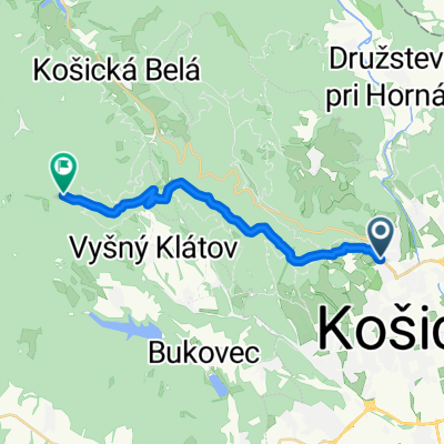
Lengthy bike tour through Košice
A cycling route starting in Košice, Košice Region, Slovakia.
Overview
About this route
Stropkovska-bankov-jahodna-lajoska-hylov-bukovec-baska-lunik XI-ciel
- -:--
- Duration
- 36.4 km
- Distance
- 771 m
- Ascent
- 771 m
- Descent
- ---
- Avg. speed
- ---
- Max. altitude

Route quality
Waytypes & surfaces along the route
Waytypes
Track
28 km
(77 %)
Road
3.3 km
(9 %)
Surfaces
Paved
2.5 km
(7 %)
Unpaved
26.5 km
(73 %)
Ground
13.8 km
(38 %)
Unpaved (undefined)
8 km
(22 %)
Route highlights
Points of interest along the route

Point of interest after 13.2 km
1st stage nad Jahodnou

Point of interest after 19.6 km
lajoska
Continue with Bikemap
Use, edit, or download this cycling route
You would like to ride Lengthy bike tour through Košice or customize it for your own trip? Here is what you can do with this Bikemap route:
Free features
- Save this route as favorite or in collections
- Copy & plan your own version of this route
- Sync your route with Garmin or Wahoo
Premium features
Free trial for 3 days, or one-time payment. More about Bikemap Premium.
- Navigate this route on iOS & Android
- Export a GPX / KML file of this route
- Create your custom printout (try it for free)
- Download this route for offline navigation
Discover more Premium features.
Get Bikemap PremiumFrom our community
Other popular routes starting in Košice
 2020_Cermel_Lajoska_I
- Distance
- 15.5 km
- Ascent
- 822 m
- Descent
- 143 m
- Location
- Košice, Košice Region, Slovakia
 Lengthy bike tour through Košice
- Distance
- 36.4 km
- Ascent
- 771 m
- Descent
- 771 m
- Location
- Košice, Košice Region, Slovakia
 Lajoška 26.6.2010
- Distance
- 43 km
- Ascent
- 851 m
- Descent
- 853 m
- Location
- Košice, Košice Region, Slovakia
 KE(Furca) - Hrasovik - Beniakovce - Vajkovce - KE(Krematorium) - KE(Furca)
- Distance
- 14.1 km
- Ascent
- 195 m
- Descent
- 190 m
- Location
- Košice, Košice Region, Slovakia
 Po stopách košických sôch I.
- Distance
- 2.2 km
- Ascent
- 8 m
- Descent
- 0 m
- Location
- Košice, Košice Region, Slovakia
 Tahanovce most-Anicka-Cermel-Alpinka-chata Hresna-Anicka-Tahanovce most
- Distance
- 22.5 km
- Ascent
- 406 m
- Descent
- 406 m
- Location
- Košice, Košice Region, Slovakia
 Jahodna Singletrack
- Distance
- 6.6 km
- Ascent
- 166 m
- Descent
- 411 m
- Location
- Košice, Košice Region, Slovakia
 Jahodna -- Bankov -- ke-kvp-MOST pri Jazdiarni
- Distance
- 10 km
- Ascent
- 103 m
- Descent
- 392 m
- Location
- Košice, Košice Region, Slovakia
Open it in the app