

Croda da Lago-Mondeval-Selva-Giau-Andraz
A cycling route starting in Cortina d'Ampezzo, Veneto, Italy.
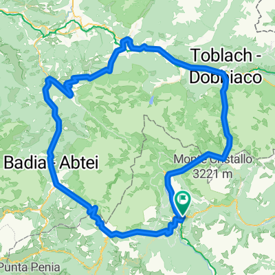
Overview
About this route
Il percorso non presenta difficoltà rilevanti e si gestisce bene a livello turistico; le uniche difficoltà stanno nel terreno scosceso nella discesa verso il passo Giau, e nella forte carenza di segnaletica (orizzontale e verticale) tra il passo Giau e il passo Falzarego. Quest'ultimo elemento ha portato a notevoli perdite di tempo e si rende necessaria una urgente sistemazione. Tuttavia per l'importanza storica, geologica e paesaggistica dei siti proposti, la camminata è piacevole e non faticosa ricca anche di dati culturali. Se c'è bisogno di collegamenti tramite mezzi si consideri oltre a Dolomitibus e CortinaExpress che praticano frequentemente tra Pso Falzarego e valli, anche la linea 465 di SAD (trasporti sudtirolesi) da Arabba-Pso Falzarego alla Val Badia.
- -:--
- Duration
- 33.3 km
- Distance
- 2,342 m
- Ascent
- 1,805 m
- Descent
- ---
- Avg. speed
- ---
- Avg. speed
Route highlights
Points of interest along the route
Drinking water after 1.1 km
lago d'Aial
Photo after 5 km
punto panoramico
Accommodation after 5.1 km
Rifugio Palmieri alla croda da lago
Photo after 7 km
forcella Ambrizzola, punto panoramico
Photo after 7.4 km
punto panoramico
Point of interest after 7.4 km
punto di rilevanza archeologica e storica: scoperta dell'uomo di Mondeval
Point of interest after 12 km
malga, vendita prodotti tipici
Accommodation after 14.4 km
centro abitato, alloggio
Photo after 18.3 km
forcella Giau, punto panoramico
Photo after 20.7 km
passo Giau
Photo after 29.2 km
castello di Andraz, punto storico-panoramico
Point of interest after 32.3 km
passo Falzarego
Continue with Bikemap
Use, edit, or download this cycling route
You would like to ride Croda da Lago-Mondeval-Selva-Giau-Andraz or customize it for your own trip? Here is what you can do with this Bikemap route:
Free features
- Save this route as favorite or in collections
- Copy & plan your own version of this route
- Sync your route with Garmin or Wahoo
Premium features
Free trial for 3 days, or one-time payment. More about Bikemap Premium.
- Navigate this route on iOS & Android
- Export a GPX / KML file of this route
- Create your custom printout (try it for free)
- Download this route for offline navigation
Discover more Premium features.
Get Bikemap PremiumFrom our community
Other popular routes starting in Cortina d'Ampezzo
 2020-09-02 18:34:14Cortina-Belluno
- Distance
- 75.2 km
- Ascent
- 1,096 m
- Descent
- 1,917 m
- Location
- Cortina d'Ampezzo, Veneto, Italy
 Cortina P. Furcia, Cimabanche
- Distance
- 121.2 km
- Ascent
- 2,206 m
- Descent
- 2,203 m
- Location
- Cortina d'Ampezzo, Veneto, Italy
 Dol 3 Zinnen
- Distance
- 16.1 km
- Ascent
- 738 m
- Descent
- 739 m
- Location
- Cortina d'Ampezzo, Veneto, Italy
 cortina giro dei sette rifugi
- Distance
- 57.2 km
- Ascent
- 1,917 m
- Descent
- 1,917 m
- Location
- Cortina d'Ampezzo, Veneto, Italy
 5 Rifugi
- Distance
- 31.6 km
- Ascent
- 1,404 m
- Descent
- 1,404 m
- Location
- Cortina d'Ampezzo, Veneto, Italy
 Cortina - Rifugio Auronzo t/r
- Distance
- 51.6 km
- Ascent
- 1,646 m
- Descent
- 1,647 m
- Location
- Cortina d'Ampezzo, Veneto, Italy
 04 Cortina d'Ampezzo - Santa Crestina
- Distance
- 59.9 km
- Ascent
- 2,189 m
- Descent
- 2,044 m
- Location
- Cortina d'Ampezzo, Veneto, Italy
 Olympia camp - Cinque torri - P. So. giau. Olympia camp
- Distance
- 44.1 km
- Ascent
- 1,715 m
- Descent
- 1,715 m
- Location
- Cortina d'Ampezzo, Veneto, Italy
Open it in the app