

RE - 42 km - Radtour zu "Jupp unner de Böcken"
A cycling route starting in Recklinghausen, North Rhine-Westphalia, Germany.
Overview
About this route
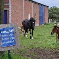
The departure is at PP Recklinghausen and leads on the outward journey via Börster Weg through the Haard to the south shore of the Haltern reservoir. The return route is through the eastern Haard to Rodelberg and then back via Dorstener Straße to the presidium.
- -:--
- Duration
- 41.8 km
- Distance
- 279 m
- Ascent
- 275 m
- Descent
- ---
- Avg. speed
- ---
- Max. altitude
Route quality
Waytypes & surfaces along the route
Waytypes
Track
16.3 km
(39 %)
Quiet road
13.8 km
(33 %)
Surfaces
Paved
20.5 km
(49 %)
Unpaved
13.8 km
(33 %)
Asphalt
14.2 km
(34 %)
Gravel
12.5 km
(30 %)
Continue with Bikemap
Use, edit, or download this cycling route
You would like to ride RE - 42 km - Radtour zu "Jupp unner de Böcken" or customize it for your own trip? Here is what you can do with this Bikemap route:
Free features
- Save this route as favorite or in collections
- Copy & plan your own version of this route
- Sync your route with Garmin or Wahoo
Premium features
Free trial for 3 days, or one-time payment. More about Bikemap Premium.
- Navigate this route on iOS & Android
- Export a GPX / KML file of this route
- Create your custom printout (try it for free)
- Download this route for offline navigation
Discover more Premium features.
Get Bikemap PremiumFrom our community
Other popular routes starting in Recklinghausen
 Recklinghausen - Waltrop - Castrop
- Distance
- 33.5 km
- Ascent
- 165 m
- Descent
- 163 m
- Location
- Recklinghausen, North Rhine-Westphalia, Germany
 Buchi's Runde
- Distance
- 58.8 km
- Ascent
- 321 m
- Descent
- 314 m
- Location
- Recklinghausen, North Rhine-Westphalia, Germany
 Marl Sinsen, Halterner Straße 16 - Flaesheim - Marl Sinsen
- Distance
- 26 km
- Ascent
- 253 m
- Descent
- 250 m
- Location
- Recklinghausen, North Rhine-Westphalia, Germany
 RE - 42 km - Radtour zu "Jupp unner de Böcken"
- Distance
- 41.8 km
- Ascent
- 279 m
- Descent
- 275 m
- Location
- Recklinghausen, North Rhine-Westphalia, Germany
 Recklinghausen Runde
- Distance
- 38.7 km
- Ascent
- 205 m
- Descent
- 202 m
- Location
- Recklinghausen, North Rhine-Westphalia, Germany
 Halterner Straße 16, Marl nach Halterner Straße 16, Marl
- Distance
- 30.2 km
- Ascent
- 328 m
- Descent
- 327 m
- Location
- Recklinghausen, North Rhine-Westphalia, Germany
 Von RE zum Rundkurs Unser-Fritz Ruhr nach Essen
- Distance
- 70.3 km
- Ascent
- 252 m
- Descent
- 249 m
- Location
- Recklinghausen, North Rhine-Westphalia, Germany
 Haard Flaes Dat (48)
- Distance
- 48.6 km
- Ascent
- 136 m
- Descent
- 140 m
- Location
- Recklinghausen, North Rhine-Westphalia, Germany
Open it in the app