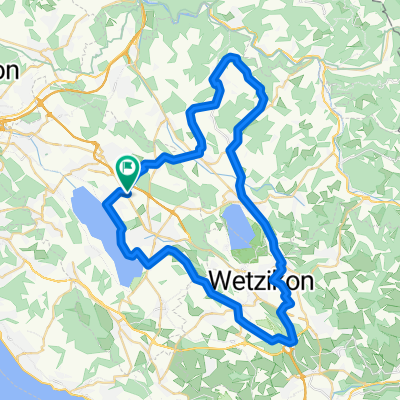
3-Gipfel-Tour: Sternenberg-Hulftegg-Ghöch
A cycling route starting in Nänikon / Nänikon (Dorfkern), Canton of Zurich, Switzerland.
Overview
About this route
- -:--
- Duration
- 83 km
- Distance
- 1,264 m
- Ascent
- 1,264 m
- Descent
- ---
- Avg. speed
- ---
- Avg. speed
Route quality
Waytypes & surfaces along the route
Waytypes
Road
49.4 km
(60 %)
Busy road
12.1 km
(15 %)
Surfaces
Paved
65.3 km
(79 %)
Unpaved
0.1 km
(<1 %)
Asphalt
64.5 km
(78 %)
Paving stones
0.5 km
(<1 %)
Continue with Bikemap
Use, edit, or download this cycling route
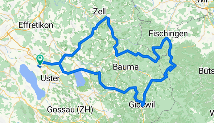
You would like to ride 3-Gipfel-Tour: Sternenberg-Hulftegg-Ghöch or customize it for your own trip? Here is what you can do with this Bikemap route:
Free features
- Save this route as favorite or in collections
- Copy & plan your own version of this route
- Sync your route with Garmin or Wahoo
Premium features
Free trial for 3 days, or one-time payment. More about Bikemap Premium.
- Navigate this route on iOS & Android
- Export a GPX / KML file of this route
- Create your custom printout (try it for free)
- Download this route for offline navigation
Discover more Premium features.
Get Bikemap PremiumFrom our community
Other popular routes starting in Nänikon / Nänikon (Dorfkern)
- Sternenberg
- Distance
- 71.2 km
- Ascent
- 764 m
- Descent
- 764 m
- Location
- Nänikon / Nänikon (Dorfkern), Canton of Zurich, Switzerland
- Schwerzistrasse 8B, Uster nach Brunnenbachstrasse 1, Hinwil
- Distance
- 16.6 km
- Ascent
- 195 m
- Descent
- 108 m
- Location
- Nänikon / Nänikon (Dorfkern), Canton of Zurich, Switzerland
- Näniker Wald
- Distance
- 4.5 km
- Ascent
- 40 m
- Descent
- 37 m
- Location
- Nänikon / Nänikon (Dorfkern), Canton of Zurich, Switzerland
- Schwerzistrasse, Nänikon nach Schwerzistrasse, Nänikon
- Distance
- 39.7 km
- Ascent
- 465 m
- Descent
- 462 m
- Location
- Nänikon / Nänikon (Dorfkern), Canton of Zurich, Switzerland
- Schüsselstudenweg, Uster nach Obermattstrasse, Pfäffikon ZH
- Distance
- 9.8 km
- Ascent
- 140 m
- Descent
- 60 m
- Location
- Nänikon / Nänikon (Dorfkern), Canton of Zurich, Switzerland
- Schwerzistrasse, Nänikon nach Schwerzistrasse, Nänikon
- Distance
- 45.6 km
- Ascent
- 379 m
- Descent
- 365 m
- Location
- Nänikon / Nänikon (Dorfkern), Canton of Zurich, Switzerland
- Swisstopo Route
- Distance
- 40.5 km
- Ascent
- 643 m
- Descent
- 645 m
- Location
- Nänikon / Nänikon (Dorfkern), Canton of Zurich, Switzerland
- Hulftegg-Ghöch
- Distance
- 77.2 km
- Ascent
- 1,003 m
- Descent
- 1,004 m
- Location
- Nänikon / Nänikon (Dorfkern), Canton of Zurich, Switzerland
Open it in the app