

Overview
About this route
- DEN = Trošku stoupačka ale s odměnou!
60km = po-ho-da :-)
koupačka u jezera BLED (viz foto)
ubytování kemp BLED ( neodepsali na ubytko a bejva tam prej dost plno takze uvidime :-) )
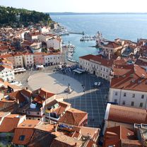
Asi nejkrásnější místo zájezdu
- -:--
- Duration
- 61.6 km
- Distance
- 1,399 m
- Ascent
- 1,442 m
- Descent
- ---
- Avg. speed
- ---
- Max. altitude

Part of
KOLA 2016
1 stage
Route quality
Waytypes & surfaces along the route
Waytypes
Quiet road
28.1 km
(46 %)
Busy road
19.4 km
(31 %)
Surfaces
Paved
43.8 km
(71 %)
Unpaved
5.9 km
(10 %)
Asphalt
42.3 km
(69 %)
Ground
2.5 km
(4 %)
Continue with Bikemap
Use, edit, or download this cycling route
You would like to ride KOLA 2016 - 2.DEN (PÁ) or customize it for your own trip? Here is what you can do with this Bikemap route:
Free features
- Save this route as favorite or in collections
- Copy & plan your own version of this route
- Sync your route with Garmin or Wahoo
Premium features
Free trial for 3 days, or one-time payment. More about Bikemap Premium.
- Navigate this route on iOS & Android
- Export a GPX / KML file of this route
- Create your custom printout (try it for free)
- Download this route for offline navigation
Discover more Premium features.
Get Bikemap PremiumFrom our community
Other popular routes starting in Köttmannsdorf
 Weizelsdorf Bahnhof (Vorplatz), Ferlach do Kappel an der Drau 27, Ferlach
- Distance
- 28.6 km
- Ascent
- 174 m
- Descent
- 175 m
- Location
- Köttmannsdorf, Carinthia, Austria
 ED-120726_Villach
- Distance
- 86.3 km
- Ascent
- 503 m
- Descent
- 502 m
- Location
- Köttmannsdorf, Carinthia, Austria
 21-I-2 f.Drau-Graz
- Distance
- 155 km
- Ascent
- 739 m
- Descent
- 836 m
- Location
- Köttmannsdorf, Carinthia, Austria
 test
test- Distance
- 0.7 km
- Ascent
- 0 m
- Descent
- 74 m
- Location
- Köttmannsdorf, Carinthia, Austria
 Kappel an der Drau 27, Ferlach do Bundesstraße 10, Lambichl
- Distance
- 29.9 km
- Ascent
- 207 m
- Descent
- 143 m
- Location
- Köttmannsdorf, Carinthia, Austria
 Ab Klagenfurt Tag 2 - 16.7.
- Distance
- 61 km
- Ascent
- 1,405 m
- Descent
- 1,427 m
- Location
- Köttmannsdorf, Carinthia, Austria
 Wörthersee Testrunde
- Distance
- 48.7 km
- Ascent
- 392 m
- Descent
- 394 m
- Location
- Köttmannsdorf, Carinthia, Austria
 Weizelsdorf Bhf - Klagenfurter Hütte - Kosiak - Ferlach - Zell Pfarre - Schaidasattel - Eisenkappel - Gösselsdorf
- Distance
- 94.4 km
- Ascent
- 2,273 m
- Descent
- 2,234 m
- Location
- Köttmannsdorf, Carinthia, Austria
Open it in the app