![Mittelgebirge Innsbruck - Pisa über Florenz [Konzept] v2](https://media.bikemap.net/routes/3679467/staticmaps/in_665e3eb8-a5b3-4d46-bbeb-a498a5491d0c_694x400_bikemap-2021-3D-static.png)
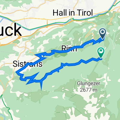
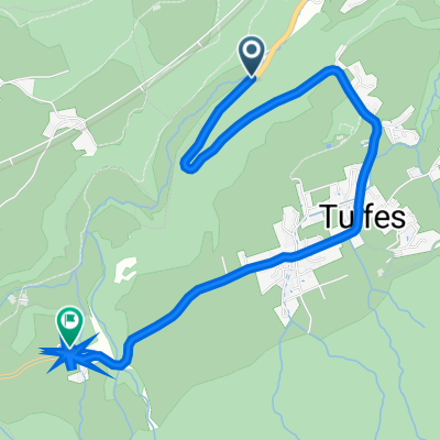
Tulferberg 14, Tulfes nach Halsmarter 1, Tulfes
- 25.5 km
- 1,542 m
- 1,097 m
- Tulfes, Tyrol, Austria
A cycling route starting in Tulfes, Tyrol, Austria.
Overview
Features:
Elevation gain and distance 'optimized'. Mostly laid out on bike paths. Includes many large cities
created this 9 years ago
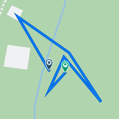
![Photo 1 of the Bikemap route "Mittelgebirge Innsbruck - Pisa über Florenz [Konzept] v2"](https://media.bikemap.net/routes/3679467/gallery/thumbs/mittelgebirge-innsbruck-pisa-uber-florenz-konzept-v2_4.png.688x400_q80_crop.png "Photo 1 of the Bikemap route \"Mittelgebirge Innsbruck - Pisa über Florenz [Konzept] v2\"")
![Photo 2 of the Bikemap route "Mittelgebirge Innsbruck - Pisa über Florenz [Konzept] v2"](https://media.bikemap.net/routes/3679467/gallery/thumbs/mittelgebirge-innsbruck-pisa-uber-florenz-konzept-v2_3.png.688x400_q80_crop.png "Photo 2 of the Bikemap route \"Mittelgebirge Innsbruck - Pisa über Florenz [Konzept] v2\"")
![Photo 3 of the Bikemap route "Mittelgebirge Innsbruck - Pisa über Florenz [Konzept] v2"](https://media.bikemap.net/routes/3679467/gallery/thumbs/mittelgebirge-innsbruck-pisa-uber-florenz-konzept-v2_2.png.208x208_q80_crop.png "Photo 3 of the Bikemap route \"Mittelgebirge Innsbruck - Pisa über Florenz [Konzept] v2\"")
![Photo 4 of the Bikemap route "Mittelgebirge Innsbruck - Pisa über Florenz [Konzept] v2"](https://media.bikemap.net/routes/3679467/gallery/thumbs/mittelgebirge-innsbruck-pisa-uber-florenz-konzept-v2_1.png.208x208_q80_crop.png "Photo 4 of the Bikemap route \"Mittelgebirge Innsbruck - Pisa über Florenz [Konzept] v2\"")
Route quality
Cycleway
198.4 km
(30 %)
Quiet road
158.7 km
(24 %)
Paved
462.9 km
(70 %)
Unpaved
26.5 km
(4 %)
Asphalt
456.3 km
(69 %)
Gravel
13.2 km
(2 %)
Continue with Bikemap
You would like to ride Mittelgebirge Innsbruck - Pisa über Florenz [Konzept] v2 or customize it for your own trip? Here is what you can do with this Bikemap route:
Free trial for 3 days, or one-time payment. More about Bikemap Premium.
Discover more Premium features.
Get Bikemap PremiumFrom our community
Open it in the app