

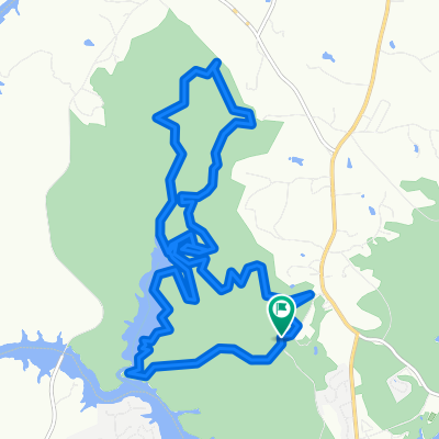
Wildcat at Isaqueena MTB
A cycling route starting in Central, South Carolina, United States.
Overview
About this route
lots of creek crossing fast downhill mostly logging roads nice waterfall
- 1 h 17 min
- Duration
- 5.4 km
- Distance
- 111 m
- Ascent
- 109 m
- Descent
- 4.2 km/h
- Avg. speed
- ---
- Max. altitude
Route photos

Continue with Bikemap
Use, edit, or download this cycling route
You would like to ride Wildcat at Isaqueena MTB or customize it for your own trip? Here is what you can do with this Bikemap route:
Free features
- Save this route as favorite or in collections
- Copy & plan your own version of this route
- Sync your route with Garmin or Wahoo
Premium features
Free trial for 3 days, or one-time payment. More about Bikemap Premium.
- Navigate this route on iOS & Android
- Export a GPX / KML file of this route
- Create your custom printout (try it for free)
- Download this route for offline navigation
Discover more Premium features.
Get Bikemap PremiumFrom our community
Other popular routes starting in Central
 issaqueena lake mtb clemson sc
- Distance
- 19 km
- Ascent
- 278 m
- Descent
- 278 m
- Location
- Central, South Carolina, United States
 mcdonalds
- Distance
- 9.6 km
- Ascent
- 107 m
- Descent
- 187 m
- Location
- Central, South Carolina, United States
 happy
happy- Distance
- 12.6 km
- Ascent
- 199 m
- Descent
- 193 m
- Location
- Central, South Carolina, United States
 Ride to and From Work
- Distance
- 36.8 km
- Ascent
- 230 m
- Descent
- 231 m
- Location
- Central, South Carolina, United States
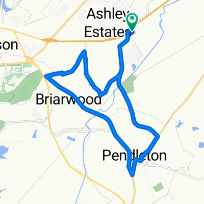 Ruta por Pendleton
- Distance
- 17.5 km
- Ascent
- 171 m
- Descent
- 173 m
- Location
- Central, South Carolina, United States
 MTB
MTB- Distance
- 21.2 km
- Ascent
- 310 m
- Descent
- 307 m
- Location
- Central, South Carolina, United States
 Central to Devils Fork State Park
- Distance
- 42.2 km
- Ascent
- 1,078 m
- Descent
- 1,002 m
- Location
- Central, South Carolina, United States
 Clemson SC Trail
- Distance
- 6.4 km
- Ascent
- 114 m
- Descent
- 115 m
- Location
- Central, South Carolina, United States
Open it in the app