

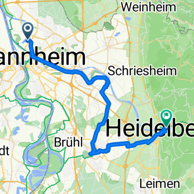
Mannheim-Weinheim-Heidelberg-Schwetzingen-Mannheim
A cycling route starting in Mannheim, Baden-Wurttemberg, Germany.
Overview
About this route
- -:--
- Duration
- 105.3 km
- Distance
- 875 m
- Ascent
- 870 m
- Descent
- ---
- Avg. speed
- 420 m
- Max. altitude
Route quality
Waytypes & surfaces along the route
Waytypes
Path
16.8 km
(16 %)
Quiet road
13.7 km
(13 %)
Surfaces
Paved
94.8 km
(90 %)
Asphalt
91.6 km
(87 %)
Paved (undefined)
3.2 km
(3 %)
Undefined
10.5 km
(10 %)
Continue with Bikemap
Use, edit, or download this cycling route
You would like to ride Mannheim-Weinheim-Heidelberg-Schwetzingen-Mannheim or customize it for your own trip? Here is what you can do with this Bikemap route:
Free features
- Save this route as favorite or in collections
- Copy & plan your own version of this route
- Split it into stages to create a multi-day tour
- Sync your route with Garmin or Wahoo
Premium features
Free trial for 3 days, or one-time payment. More about Bikemap Premium.
- Navigate this route on iOS & Android
- Export a GPX / KML file of this route
- Create your custom printout (try it for free)
- Download this route for offline navigation
Discover more Premium features.
Get Bikemap PremiumFrom our community
Other popular routes starting in Mannheim
 Von Mannheim bis Heidelberg
- Distance
- 37.9 km
- Ascent
- 85 m
- Descent
- 63 m
- Location
- Mannheim, Baden-Wurttemberg, Germany
 Trainingsrunde
- Distance
- 69.5 km
- Ascent
- 630 m
- Descent
- 619 m
- Location
- Mannheim, Baden-Wurttemberg, Germany
 Apfelbaumtour 2
- Distance
- 70.6 km
- Ascent
- 1,077 m
- Descent
- 1,081 m
- Location
- Mannheim, Baden-Wurttemberg, Germany
 Mannheim Abendrunde
- Distance
- 50.9 km
- Ascent
- 477 m
- Descent
- 472 m
- Location
- Mannheim, Baden-Wurttemberg, Germany
 Mannheim Paradeplatz,via Reißinsel und Neckarau nach Nationaltheater Mannheim
- Distance
- 17 km
- Ascent
- 326 m
- Descent
- 327 m
- Location
- Mannheim, Baden-Wurttemberg, Germany
 Ludwigshafen am Rhein - Budenheim
- Distance
- 83.3 km
- Ascent
- 215 m
- Descent
- 227 m
- Location
- Mannheim, Baden-Wurttemberg, Germany
 Odenwälder Hügel-Hopping
- Distance
- 63.1 km
- Ascent
- 989 m
- Descent
- 987 m
- Location
- Mannheim, Baden-Wurttemberg, Germany
 Die Hausrunde XL (Rundweg um Mannheim)
- Distance
- 48.9 km
- Ascent
- 47 m
- Descent
- 47 m
- Location
- Mannheim, Baden-Wurttemberg, Germany
Open it in the app