

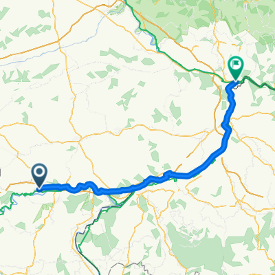
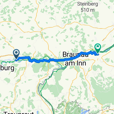
Töging-Aschau
A cycling route starting in Töging am Inn, Bavaria, Germany.
Overview
About this route
- -:--
- Duration
- 21.1 km
- Distance
- ---
- Ascent
- ---
- Descent
- ---
- Avg. speed
- ---
- Max. altitude
Route quality
Waytypes & surfaces along the route
Waytypes
Road
8.2 km
(39 %)
Path
5.7 km
(27 %)
Surfaces
Paved
15 km
(71 %)
Unpaved
4.6 km
(22 %)
Asphalt
14.8 km
(70 %)
Gravel
2.5 km
(12 %)
Continue with Bikemap
Use, edit, or download this cycling route
You would like to ride Töging-Aschau or customize it for your own trip? Here is what you can do with this Bikemap route:
Free features
- Save this route as favorite or in collections
- Copy & plan your own version of this route
- Sync your route with Garmin or Wahoo
Premium features
Free trial for 3 days, or one-time payment. More about Bikemap Premium.
- Navigate this route on iOS & Android
- Export a GPX / KML file of this route
- Create your custom printout (try it for free)
- Download this route for offline navigation
Discover more Premium features.
Get Bikemap PremiumFrom our community
Other popular routes starting in Töging am Inn
 17546744
- Distance
- 14.1 km
- Ascent
- 233 m
- Descent
- 236 m
- Location
- Töging am Inn, Bavaria, Germany
 holzlandrunde
- Distance
- 40.8 km
- Ascent
- 312 m
- Descent
- 327 m
- Location
- Töging am Inn, Bavaria, Germany
 Inn Radweg
- Distance
- 24.7 km
- Ascent
- 91 m
- Descent
- 120 m
- Location
- Töging am Inn, Bavaria, Germany
 Zuhause nach Arbeit
- Distance
- 12.9 km
- Ascent
- 57 m
- Descent
- 60 m
- Location
- Töging am Inn, Bavaria, Germany
 Hauptstraße, Töging a.Inn nach Höllgasse, Passau
- Distance
- 102.4 km
- Ascent
- 438 m
- Descent
- 523 m
- Location
- Töging am Inn, Bavaria, Germany
 Mühldorfer Straße, Töging am Inn nach Mühlheim am Inn
- Distance
- 58.1 km
- Ascent
- 183 m
- Descent
- 236 m
- Location
- Töging am Inn, Bavaria, Germany
 Rundfahrt Landkreise Altötting Mühldorf
- Distance
- 39.3 km
- Ascent
- 84 m
- Descent
- 86 m
- Location
- Töging am Inn, Bavaria, Germany
 Seemanshausen
- Distance
- 30.5 km
- Ascent
- 257 m
- Descent
- 172 m
- Location
- Töging am Inn, Bavaria, Germany
Open it in the app