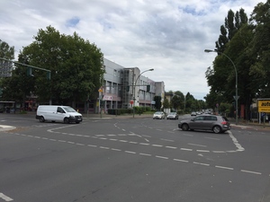
Ausfahrt durch Berlin
A cycling route starting in Lichterfelde, State of Berlin, Germany.
Overview
About this route
- -:--
- Duration
- 32.7 km
- Distance
- 57 m
- Ascent
- 60 m
- Descent
- ---
- Avg. speed
- ---
- Max. altitude
Route quality
Waytypes & surfaces along the route
Waytypes
Pedestrian area
8.3 km
(25 %)
Quiet road
6.8 km
(21 %)
Surfaces
Paved
25.7 km
(78 %)
Unpaved
2.4 km
(7 %)
Asphalt
19.7 km
(60 %)
Paving stones
5.9 km
(18 %)
Route highlights
Points of interest along the route

Point of interest after 0.3 km
villengegend Lichterfelde West

Point of interest after 0.5 km
Gaslaternengegend ✨

Point of interest after 2.5 km
Berlner Süden

Point of interest after 2.5 km
Überall Orte des Dchreckens und der Besinnung. Vorsicht vor diesem VOLK

Point of interest after 2.5 km
Ab jetzt am Teltowkanal entlang

Point of interest after 3.1 km
Kraftwerk Lichterfelde am Kanal

Point of interest after 4.5 km
Am BJFC

Point of interest after 4.6 km
Teltowkanal After nach diesem Vorbild hat man dann den Panamakanal gebaut

Point of interest after 5.1 km
Hilfe kommt

Point of interest after 6.7 km
Stadtpark Steglitz

Point of interest after 7.7 km
Fußgänger Brücke

Point of interest after 8.7 km
wo ist der Teltowkanal?

Point of interest after 9.7 km
weg

Photo after 11.6 km
Ullstein House

Photo after 11.7 km
Tempelhofer Hafen

Photo after 18.9 km
Central Flughafen Berlin Tempelhof

Photo after 20 km
Korean Barbecue am Volkspark Hh

Point of interest after 21.2 km
Berliner Mietshaus klassische Gründerzeit

Point of interest after 22.1 km
Landwehrkanal am Maybachufer in Kreizberg

Photo after 23.7 km
Van Loon Restaurantschiff

Photo after 25 km
Hallesches Tor

Point of interest after 26.1 km
Berlin Technikmuseum

Point of interest after 26.1 km
dito

Point of interest after 26.2 km
Berlin die U-Bahn fährt durch ein hais

Point of interest after 26.4 km
Urbaner Landwehrkanal

Point of interest after 27.4 km
Berlin Potsdamer Platz für nd Finito 🚋🚋🚋
Continue with Bikemap
Use, edit, or download this cycling route
You would like to ride Ausfahrt durch Berlin or customize it for your own trip? Here is what you can do with this Bikemap route:
Free features
- Save this route as favorite or in collections
- Copy & plan your own version of this route
- Sync your route with Garmin or Wahoo
Premium features
Free trial for 3 days, or one-time payment. More about Bikemap Premium.
- Navigate this route on iOS & Android
- Export a GPX / KML file of this route
- Create your custom printout (try it for free)
- Download this route for offline navigation
Discover more Premium features.
Get Bikemap PremiumFrom our community
Other popular routes starting in Lichterfelde
 Route in Berlin
- Distance
- 32.4 km
- Ascent
- 134 m
- Descent
- 139 m
- Location
- Lichterfelde, State of Berlin, Germany
 RTF Umland 70 km
- Distance
- 72 km
- Ascent
- 128 m
- Descent
- 125 m
- Location
- Lichterfelde, State of Berlin, Germany
 MTB-Runde Teltowkanal, Wannsee, Grunewald
- Distance
- 59.3 km
- Ascent
- 244 m
- Descent
- 243 m
- Location
- Lichterfelde, State of Berlin, Germany
 Schöne Griebnitzsee Tour
- Distance
- 32.7 km
- Ascent
- 101 m
- Descent
- 104 m
- Location
- Lichterfelde, State of Berlin, Germany
 Herbst im Wald
- Distance
- 20.6 km
- Ascent
- 50 m
- Descent
- 51 m
- Location
- Lichterfelde, State of Berlin, Germany
 VELOTHON Berlin 2011 >>Brandenburg-Schleife <<
- Distance
- 70.6 km
- Ascent
- 68 m
- Descent
- 70 m
- Location
- Lichterfelde, State of Berlin, Germany
 Ausfahrt durch Berlin
- Distance
- 32.7 km
- Ascent
- 57 m
- Descent
- 60 m
- Location
- Lichterfelde, State of Berlin, Germany
 DFB Pokal in der City
- Distance
- 25.6 km
- Ascent
- 60 m
- Descent
- 57 m
- Location
- Lichterfelde, State of Berlin, Germany
Open it in the app


