

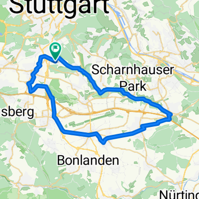
20160421_172205.gpx
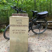
A cycling route starting in Leinfelden-Echterdingen, Baden-Wurttemberg, Germany.
Overview
About this route
TEASI track
- -:--
- Duration
- 21.3 km
- Distance
- 280 m
- Ascent
- 280 m
- Descent
- ---
- Avg. speed
- ---
- Max. altitude

Route quality
Waytypes & surfaces along the route
Waytypes
Track
9 km
(42 %)
Path
7.5 km
(35 %)
Surfaces
Paved
14.7 km
(69 %)
Unpaved
5.3 km
(25 %)
Asphalt
12.4 km
(58 %)
Loose gravel
3.8 km
(18 %)
Continue with Bikemap
Use, edit, or download this cycling route
You would like to ride 20160421_172205.gpx or customize it for your own trip? Here is what you can do with this Bikemap route:
Free features
- Save this route as favorite or in collections
- Copy & plan your own version of this route
- Sync your route with Garmin or Wahoo
Premium features
Free trial for 3 days, or one-time payment. More about Bikemap Premium.
- Navigate this route on iOS & Android
- Export a GPX / KML file of this route
- Create your custom printout (try it for free)
- Download this route for offline navigation
Discover more Premium features.
Get Bikemap PremiumFrom our community
Other popular routes starting in Leinfelden-Echterdingen
 Echterdingen, Waldfriedhof Stgt., Bärensee, Solitude
- Distance
- 43.9 km
- Ascent
- 418 m
- Descent
- 418 m
- Location
- Leinfelden-Echterdingen, Baden-Wurttemberg, Germany
 Hausstrecke
- Distance
- 56.2 km
- Ascent
- 505 m
- Descent
- 482 m
- Location
- Leinfelden-Echterdingen, Baden-Wurttemberg, Germany
 Rund um Böblingen
- Distance
- 65.7 km
- Ascent
- 604 m
- Descent
- 654 m
- Location
- Leinfelden-Echterdingen, Baden-Wurttemberg, Germany
 Möhringen - Reutlingen grün 42km 430hm
- Distance
- 42.6 km
- Ascent
- 388 m
- Descent
- 423 m
- Location
- Leinfelden-Echterdingen, Baden-Wurttemberg, Germany
 Filderradrunde
- Distance
- 56.9 km
- Ascent
- 476 m
- Descent
- 474 m
- Location
- Leinfelden-Echterdingen, Baden-Wurttemberg, Germany
 2009-06-18 MTB
- Distance
- 35.4 km
- Ascent
- 529 m
- Descent
- 529 m
- Location
- Leinfelden-Echterdingen, Baden-Wurttemberg, Germany
 Möhringen 49km Mitte BW_Maichingen Dagersheim Böblingen Römerstr. 490hm
- Distance
- 48.9 km
- Ascent
- 348 m
- Descent
- 353 m
- Location
- Leinfelden-Echterdingen, Baden-Wurttemberg, Germany
 Rundstrecke Hoffeld-Denkendorf-Hoffeld
- Distance
- 36.7 km
- Ascent
- 238 m
- Descent
- 259 m
- Location
- Leinfelden-Echterdingen, Baden-Wurttemberg, Germany
Open it in the app