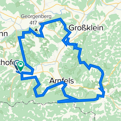
Südweststeirische vier Sanktus Runde
- 70.2 km
- 1,253 m
- 1,251 m
- Oberhaag, Styria, Austria
A cycling route starting in Oberhaag, Styria, Austria.
Overview
created this 9 years ago
Route quality
Quiet road
23.9 km
(34 %)
Cycleway
1.4 km
(2 %)
Paved
26 km
(37 %)
Unpaved
0.7 km
(1 %)
Asphalt
26 km
(37 %)
Ground
0.7 km
(1 %)
Undefined
43.5 km
(62 %)
Continue with Bikemap
You would like to ride Südweststeirische vier Sanktus Runde or customize it for your own trip? Here is what you can do with this Bikemap route:
Free trial for 3 days, or one-time payment. More about Bikemap Premium.
Discover more Premium features.
Get Bikemap PremiumFrom our community
Open it in the app