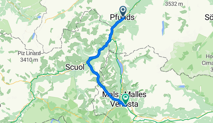

10. Etappe: Camping Via Claudiasee - Valentino
- 46.5 km
- 1,103 m
- 611 m
- Pfunds, Tyrol, Austria
A cycling route starting in Pfunds, Tyrol, Austria.
Overview
Pfunds - Glurns Sie verlassen Tirol und folgen dem Inn bis nach Sur En. Jetzt wird‘s spannend, das Val d’Uina eine der schönsten Schluchten, liegt vor Ihnen. Zunächst geht es noch auf Wald- und Schotterpisten hoch bis zu einer Alm. Die letzten Kuhweiden lassen Sie hinter sich, dann folgen Sie einem schmalen, in Fels gehauenen Steig zum Schlinigpass. Auf Trails geht es dann zur Sesvenna-Hütte (2256m) mit besten Ausblicken auf den 3900 Meter hohen, vergletscherten Ortler. Auf aussichtsreicher Piste fahren Sie hinunter nach Schlynig und weiter nach Glurns, Ihrem Etappenziel. [59 km, 1598 hm, S↑ 250 hm, F/A]
created this 9 years ago
Continue with Bikemap
You would like to ride AC_ET2_Pfunds-Glurns_(Uina-Schlucht) or customize it for your own trip? Here is what you can do with this Bikemap route:
Free trial for 3 days, or one-time payment. More about Bikemap Premium.
Discover more Premium features.
Get Bikemap PremiumFrom our community
Open it in the app