

Radstrecke Silberstrom-Triathlon 2016
- 9.8 km
- 166 m
- 165 m
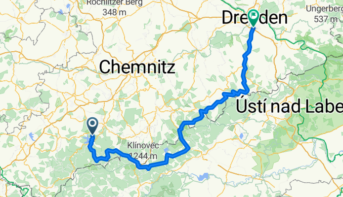
- Zschorlau, Saxony, Germany
A cycling route starting in Zschorlau, Saxony, Germany.
Overview
passing the highest peaks of the Ore Mountains towards the 24-hour elevation record in Holzhau
created this 9 years ago
Route quality
Quiet road
15 km
8 %
Track
9.4 km
5 %
Paved
148.2 km
(79 %)
Unpaved
5.6 km
(3 %)
Asphalt
148.2 km
79 %
Unpaved (undefined)
5.6 km
3 %
Undefined
33.8 km
18 %
Route highlights
24h Finish
24h Start
Continue with Bikemap
You would like to ride Zschorlau - DD über Holzhau or customize it for your own trip? Here is what you can do with this Bikemap route:
Free trial for 3 days, or one-time payment. More about Bikemap Premium.
Discover more Premium features.
Get Bikemap PremiumFrom our community
Open it in the app


