somme to calais
A cycling route starting in Albert, Nord-Pas-de-Calais-Picardie, France.
Overview
About this route
- -:--
- Duration
- 273.8 km
- Distance
- 604 m
- Ascent
- 694 m
- Descent
- ---
- Avg. speed
- ---
- Avg. speed
Route highlights
Points of interest along the route
Point of interest after 36.7 km
Ruins Abbey Mont-Saint-Éloi
Point of interest after 56.7 km
Bunker Tinques
Point of interest after 75.1 km
Launch Facility V-1 Siracourt (Wasserwerk 1 St.-Pol)
Point of interest after 85.4 km
Underground V2 storagetunnels
Point of interest after 89.8 km
German Radiocentre Prédefin
Point of interest after 97.4 km
Remains Launch Base V1
Point of interest after 106.6 km
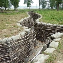
Bunker Auchy-au-Bois
Point of interest after 120.8 km
V2 Leitstrahlstellung Roquetoire
Point of interest after 127.4 km
V1 Feuerstellung 622 - FA Depot
Point of interest after 127.4 km
V1 Feuerstellung 622 - FA Vormontage
Point of interest after 127.4 km
V1 Feuerstellung 622 - Waterbasin
Point of interest after 127.4 km
V1 Feuerstellung 622 - FA Dampferzeuger-Garage
Point of interest after 145.6 km
V1 Feuerstellung 623 - FA Depot 2
Point of interest after 145.8 km
V1 Lauch facility
Point of interest after 145.9 km
V1 Feuerstellung 623 - Concrete Roads
Point of interest after 145.9 km
V1 Feuerstellung 623 - Zunderlager
Point of interest after 145.9 km
V1 Feuerstellung 623 - Richthaus
Point of interest after 146 km
V1 Feuerstellung 623 - FA Lager
Point of interest after 146 km
V1 Feuerstellung 623 - FA Depot 1
Point of interest after 146 km
V1 Feuerstellung 623 - FA Abschußbunker
Point of interest after 146 km
V1 Feuerstellung 623 - FA Vormontage
Point of interest after 146 km
V1 Feuerstellung 623 - Abshußrampe
Point of interest after 146 km
V1 Feuerstellung 623 - Waterbasin
Point of interest after 146 km
V1 Feuerstellung 623 - FA Depot 3
Point of interest after 272.7 km
The Migrant Camp
Continue with Bikemap
Use, edit, or download this cycling route
You would like to ride somme to calais or customize it for your own trip? Here is what you can do with this Bikemap route:
Free features
- Save this route as favorite or in collections
- Copy & plan your own version of this route
- Sync your route with Garmin or Wahoo
Premium features
Free trial for 3 days, or one-time payment. More about Bikemap Premium.
- Navigate this route on iOS & Android
- Export a GPX / KML file of this route
- Create your custom printout (try it for free)
- Download this route for offline navigation
Discover more Premium features.
Get Bikemap PremiumFrom our community
Other popular routes starting in Albert
- De Rue Edouard Herriot 40, Albert à Rue Jules Verne 12, Albert
- Distance
- 5.6 km
- Ascent
- 13 m
- Descent
- 31 m
- Location
- Albert, Nord-Pas-de-Calais-Picardie, France
- Rue Gambetta 4, Albert to LONGUEVAL - Place Bulte, Longueval
- Distance
- 15.4 km
- Ascent
- 164 m
- Descent
- 81 m
- Location
- Albert, Nord-Pas-de-Calais-Picardie, France
- Albert to St Quentin
- Distance
- 54.7 km
- Ascent
- 318 m
- Descent
- 308 m
- Location
- Albert, Nord-Pas-de-Calais-Picardie, France
- Somme NW from Albert
- Distance
- 52.5 km
- Ascent
- 291 m
- Descent
- 291 m
- Location
- Albert, Nord-Pas-de-Calais-Picardie, France
- Albert - Péronne (70km) - La fére (70km) - Chery les Pouilly
- Distance
- 139.2 km
- Ascent
- 438 m
- Descent
- 444 m
- Location
- Albert, Nord-Pas-de-Calais-Picardie, France
- Albert to Laon
- Distance
- 108.8 km
- Ascent
- 203 m
- Descent
- 175 m
- Location
- Albert, Nord-Pas-de-Calais-Picardie, France
- D73, Thiepval to Rue du Château 12, Thiepval
- Distance
- 13.2 km
- Ascent
- 137 m
- Descent
- 179 m
- Location
- Albert, Nord-Pas-de-Calais-Picardie, France
- Rue d'Albert 27B, Authuille to Rue d'Albert 23B, Authuille
- Distance
- 13.4 km
- Ascent
- 150 m
- Descent
- 199 m
- Location
- Albert, Nord-Pas-de-Calais-Picardie, France
Open it in the app