Ringwood/Eastlink/Blind Creek Loop
A cycling route starting in Croydon South, Victoria, Australia.
Overview
About this route
Start with steep climb up Eastfield Rd.
Then cruise past Ringwood and Eastland S/C.
Great view from the Maroondah Hwy. overpass.
Long cruise to Knox where you can get a snack.
Blind Creek trail is bumpy between Knox and the railway. Good long gentle downhill run to Bayswater.
- -:--
- Duration
- 33 km
- Distance
- 151 m
- Ascent
- 154 m
- Descent
- ---
- Avg. speed
- ---
- Max. altitude
Continue with Bikemap
Use, edit, or download this cycling route
You would like to ride Ringwood/Eastlink/Blind Creek Loop or customize it for your own trip? Here is what you can do with this Bikemap route:
Free features
- Save this route as favorite or in collections
- Copy & plan your own version of this route
- Sync your route with Garmin or Wahoo
Premium features
Free trial for 3 days, or one-time payment. More about Bikemap Premium.
- Navigate this route on iOS & Android
- Export a GPX / KML file of this route
- Create your custom printout (try it for free)
- Download this route for offline navigation
Discover more Premium features.
Get Bikemap PremiumFrom our community
Other popular routes starting in Croydon South
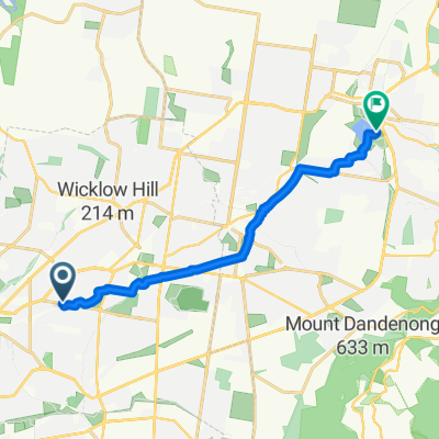
Ringwood East station- Distance
- 2.4 km
- Ascent
- 70 m
- Descent
- 34 m
- Location
- Croydon South, Victoria, Australia
Mark and Petes big adventure- Distance
- 70.5 km
- Ascent
- 211 m
- Descent
- 221 m
- Location
- Croydon South, Victoria, Australia
30km Loop via Boronia- Distance
- 30.1 km
- Ascent
- 110 m
- Descent
- 122 m
- Location
- Croydon South, Victoria, Australia
First Ride Back- Distance
- 2.2 km
- Ascent
- 5 m
- Descent
- 17 m
- Location
- Croydon South, Victoria, Australia
Eastern Fwy. Gardiners Ck. Canterbury Rd Loop- Distance
- 69.9 km
- Ascent
- 351 m
- Descent
- 351 m
- Location
- Croydon South, Victoria, Australia
To Croydon Stn- Distance
- 3.3 km
- Ascent
- 23 m
- Descent
- 11 m
- Location
- Croydon South, Victoria, Australia
Eastfield Hill Loop- Distance
- 4.6 km
- Ascent
- 79 m
- Descent
- 81 m
- Location
- Croydon South, Victoria, Australia
Ringwood/Eastlink/Blind Creek Loop- Distance
- 33 km
- Ascent
- 151 m
- Descent
- 154 m
- Location
- Croydon South, Victoria, Australia
Open it in the app

