

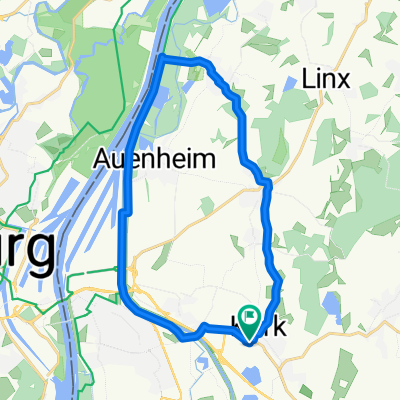
Korkrunde 1
A cycling route starting in Willstätt, Baden-Wurttemberg, Germany.
Overview
About this route
Kork, Diersheim, Rhein, Auenheim, Kork
- -:--
- Duration
- 37.3 km
- Distance
- 40 m
- Ascent
- 41 m
- Descent
- ---
- Avg. speed
- ---
- Max. altitude

Route quality
Waytypes & surfaces along the route
Waytypes
Track
13.4 km
(36 %)
Quiet road
12.3 km
(33 %)
Surfaces
Paved
26.1 km
(70 %)
Unpaved
6 km
(16 %)
Asphalt
23.1 km
(62 %)
Gravel
4.5 km
(12 %)
Continue with Bikemap
Use, edit, or download this cycling route
You would like to ride Korkrunde 1 or customize it for your own trip? Here is what you can do with this Bikemap route:
Free features
- Save this route as favorite or in collections
- Copy & plan your own version of this route
- Sync your route with Garmin or Wahoo
Premium features
Free trial for 3 days, or one-time payment. More about Bikemap Premium.
- Navigate this route on iOS & Android
- Export a GPX / KML file of this route
- Create your custom printout (try it for free)
- Download this route for offline navigation
Discover more Premium features.
Get Bikemap PremiumFrom our community
Other popular routes starting in Willstätt
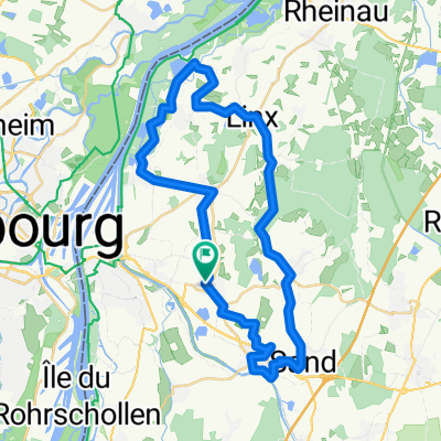
 Korkrunde 4
- Distance
- 28.7 km
- Ascent
- 24 m
- Descent
- 26 m
- Location
- Willstätt, Baden-Wurttemberg, Germany
 Kinzigtalradweg von willstätt bis Quelle
- Distance
- 84.8 km
- Ascent
- 672 m
- Descent
- 44 m
- Location
- Willstätt, Baden-Wurttemberg, Germany
 kleine runde über den rohschollen
- Distance
- 37.9 km
- Ascent
- 408 m
- Descent
- 409 m
- Location
- Willstätt, Baden-Wurttemberg, Germany
 Rund um Kehl
- Distance
- 27.2 km
- Ascent
- 49 m
- Descent
- 51 m
- Location
- Willstätt, Baden-Wurttemberg, Germany
 Kork Rhein Kehl
- Distance
- 21.2 km
- Ascent
- 48 m
- Descent
- 48 m
- Location
- Willstätt, Baden-Wurttemberg, Germany
 Meine Lieblingsstrecke am Sonntag
- Distance
- 84.3 km
- Ascent
- 864 m
- Descent
- 866 m
- Location
- Willstätt, Baden-Wurttemberg, Germany
 Crisp ride in Kehl
- Distance
- 42.9 km
- Ascent
- 401 m
- Descent
- 401 m
- Location
- Willstätt, Baden-Wurttemberg, Germany
 Chorturmkirchen Südroute
- Distance
- 38.8 km
- Ascent
- 38 m
- Descent
- 38 m
- Location
- Willstätt, Baden-Wurttemberg, Germany
Open it in the app