

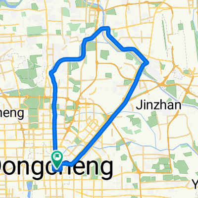
Natooke Night Tour
A cycling route starting in Jingshan, Beijing Municipality, China.
Overview
About this route
- -:--
- Duration
- 20.9 km
- Distance
- 77 m
- Ascent
- 79 m
- Descent
- ---
- Avg. speed
- ---
- Max. altitude
Route highlights
Points of interest along the route

Point of interest after 0 km
Natooke
Point of interest after 3.9 km
Hutongs
Point of interest after 4 km
Houhai Lake Area

Point of interest after 11.2 km
Tiananmen Square
Point of interest after 11.9 km
Chang'an Avenue
Point of interest after 15.3 km
Central Business District
Continue with Bikemap
Use, edit, or download this cycling route
You would like to ride Natooke Night Tour or customize it for your own trip? Here is what you can do with this Bikemap route:
Free features
- Save this route as favorite or in collections
- Copy & plan your own version of this route
- Sync your route with Garmin or Wahoo
Premium features
Free trial for 3 days, or one-time payment. More about Bikemap Premium.
- Navigate this route on iOS & Android
- Export a GPX / KML file of this route
- Create your custom printout (try it for free)
- Download this route for offline navigation
Discover more Premium features.
Get Bikemap PremiumFrom our community
Other popular routes starting in Jingshan
 Beijing - Python Hill (Mangshan) - Beijing
- Distance
- 105 km
- Ascent
- 927 m
- Descent
- 926 m
- Location
- Jingshan, Beijing Municipality, China
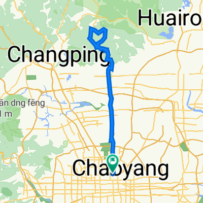
 north loop huairou
- Distance
- 130.2 km
- Ascent
- 375 m
- Descent
- 375 m
- Location
- Jingshan, Beijing Municipality, China
 Natooke Olympic Park/798 Tour
- Distance
- 32.6 km
- Ascent
- 59 m
- Descent
- 62 m
- Location
- Jingshan, Beijing Municipality, China
 Natooke Night Tour
- Distance
- 20.9 km
- Ascent
- 77 m
- Descent
- 79 m
- Location
- Jingshan, Beijing Municipality, China
 From my home to my cottage
- Distance
- 96.9 km
- Ascent
- 971 m
- Descent
- 666 m
- Location
- Jingshan, Beijing Municipality, China
 Dongzhimen to Xizhimen, Beijing
- Distance
- 8.1 km
- Ascent
- 41 m
- Descent
- 41 m
- Location
- Jingshan, Beijing Municipality, China
 Tiantongyuan - Shunyi
- Distance
- 46.7 km
- Ascent
- 67 m
- Descent
- 63 m
- Location
- Jingshan, Beijing Municipality, China
 We❤️ 北京DV Twilight 108km 578m
- Distance
- 107.5 km
- Ascent
- 493 m
- Descent
- 493 m
- Location
- Jingshan, Beijing Municipality, China
Open it in the app