

Borghorst - Laer - Hostmar (Ab Hotel Schünnemann)
A cycling route starting in Steinfurt, North Rhine-Westphalia, Germany.
Overview
About this route
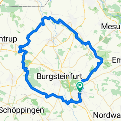
Borghorst - Laer - Hostmar (Ab Hotel Schünnemann)
- -:--
- Duration
- 48.3 km
- Distance
- 143 m
- Ascent
- 142 m
- Descent
- ---
- Avg. speed
- ---
- Max. altitude

Route quality
Waytypes & surfaces along the route
Waytypes
Quiet road
31.4 km
(65 %)
Track
8.2 km
(17 %)
Surfaces
Paved
24.1 km
(50 %)
Unpaved
6.3 km
(13 %)
Asphalt
23.6 km
(49 %)
Gravel
4.8 km
(10 %)
Continue with Bikemap
Use, edit, or download this cycling route
You would like to ride Borghorst - Laer - Hostmar (Ab Hotel Schünnemann) or customize it for your own trip? Here is what you can do with this Bikemap route:
Free features
- Save this route as favorite or in collections
- Copy & plan your own version of this route
- Sync your route with Garmin or Wahoo
Premium features
Free trial for 3 days, or one-time payment. More about Bikemap Premium.
- Navigate this route on iOS & Android
- Export a GPX / KML file of this route
- Create your custom printout (try it for free)
- Download this route for offline navigation
Discover more Premium features.
Get Bikemap PremiumFrom our community
Other popular routes starting in Steinfurt
 CE120225
- Distance
- 25.4 km
- Ascent
- 129 m
- Descent
- 132 m
- Location
- Steinfurt, North Rhine-Westphalia, Germany
 Runde bei Steinfurt
- Distance
- 67.6 km
- Ascent
- 178 m
- Descent
- 178 m
- Location
- Steinfurt, North Rhine-Westphalia, Germany
 Steinfurt_Wasserschlösser
- Distance
- 43.6 km
- Ascent
- 128 m
- Descent
- 125 m
- Location
- Steinfurt, North Rhine-Westphalia, Germany
 Auf X Rad- und Wanderwegen rund Steinfurt
- Distance
- 59.2 km
- Ascent
- 102 m
- Descent
- 102 m
- Location
- Steinfurt, North Rhine-Westphalia, Germany
 Seentour
- Distance
- 54.6 km
- Ascent
- 141 m
- Descent
- 161 m
- Location
- Steinfurt, North Rhine-Westphalia, Germany
 2009 11 22 Borghorst - Bagno/B54n/MetelenLand/Dumte
- Distance
- 31.9 km
- Ascent
- 80 m
- Descent
- 80 m
- Location
- Steinfurt, North Rhine-Westphalia, Germany
 Oflumer See
- Distance
- 36.2 km
- Ascent
- 59 m
- Descent
- 62 m
- Location
- Steinfurt, North Rhine-Westphalia, Germany
 Sellen
- Distance
- 19 km
- Ascent
- 56 m
- Descent
- 56 m
- Location
- Steinfurt, North Rhine-Westphalia, Germany
Open it in the app