

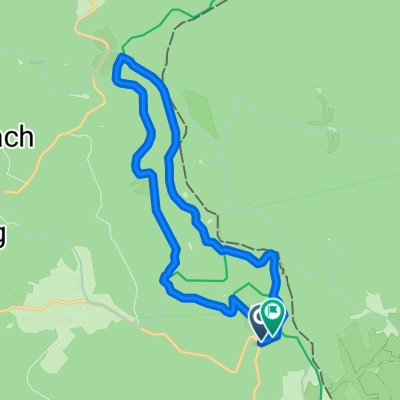
Ostrůvek-Tachov-Ostrůvek
A cycling route starting in Tachov, Plzeň Region, Czechia.
Overview
About this route
The more information you write here, the more useful it will be for other users.<br /><br />* Route details.<br />* What is special about this route?<br />* Why recommend this route?<br />* What did you like the most here?<br />* Etc.
- -:--
- Duration
- 60.9 km
- Distance
- 806 m
- Ascent
- 872 m
- Descent
- ---
- Avg. speed
- 750 m
- Max. altitude
Route quality
Waytypes & surfaces along the route
Waytypes
Road
32.3 km
(53 %)
Track
16.5 km
(27 %)
Surfaces
Paved
31.1 km
(51 %)
Unpaved
3 km
(5 %)
Asphalt
31.1 km
(51 %)
Gravel
3 km
(5 %)
Undefined
26.8 km
(44 %)
Continue with Bikemap
Use, edit, or download this cycling route
You would like to ride Ostrůvek-Tachov-Ostrůvek or customize it for your own trip? Here is what you can do with this Bikemap route:
Free features
- Save this route as favorite or in collections
- Copy & plan your own version of this route
- Sync your route with Garmin or Wahoo
Premium features
Free trial for 3 days, or one-time payment. More about Bikemap Premium.
- Navigate this route on iOS & Android
- Export a GPX / KML file of this route
- Create your custom printout (try it for free)
- Download this route for offline navigation
Discover more Premium features.
Get Bikemap PremiumFrom our community
Other popular routes starting in Tachov
 Tachov - Stribro B
- Distance
- 44.8 km
- Ascent
- 578 m
- Descent
- 633 m
- Location
- Tachov, Plzeň Region, Czechia
 Z Tachova na Havran
- Distance
- 50.1 km
- Ascent
- 736 m
- Descent
- 736 m
- Location
- Tachov, Plzeň Region, Czechia
 Ostrůvek-Tachov-Ostrůvek
- Distance
- 60.9 km
- Ascent
- 806 m
- Descent
- 872 m
- Location
- Tachov, Plzeň Region, Czechia
 11_Tachov_Pfreimd
- Distance
- 68.1 km
- Ascent
- 417 m
- Descent
- 524 m
- Location
- Tachov, Plzeň Region, Czechia
 08 Tachov - nejzápadnější bod - Hazlov
- Distance
- 116.5 km
- Ascent
- 1,069 m
- Descent
- 1,015 m
- Location
- Tachov, Plzeň Region, Czechia
 Oldrichov-Pavlovice
- Distance
- 27.5 km
- Ascent
- 287 m
- Descent
- 287 m
- Location
- Tachov, Plzeň Region, Czechia
 Gehenhammer Sielberhütte
- Distance
- 13 km
- Ascent
- 253 m
- Descent
- 237 m
- Location
- Tachov, Plzeň Region, Czechia
 Tachov - Bor -Tachov
- Distance
- 56.2 km
- Ascent
- 617 m
- Descent
- 561 m
- Location
- Tachov, Plzeň Region, Czechia
Open it in the app