Day 1.2
- 23.7 km
- 110 m
- 125 m
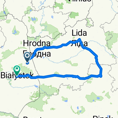
- Sokółka, Podlasie Voivodship, Poland
A cycling route starting in Sokółka, Podlasie Voivodship, Poland.
Overview
Some summaries after the first week of trips around Sokółka. Generally very good roads, mostly with new asphalt funded by EU money. This definitely contradicts opinions about the forgotten eastern wall. Gravel roads are also in good condition, rather hard and compact, not loose sands. The terrain is nicely hilly, which makes for fun surprises like “what's over that hill?”. And very beautiful landscapes. Generally, I traveled off the main trails, and bicycle traffic was minimal, car traffic also quite modest. Overall, it was great cycling. Among interesting places worth seeing, first and foremost Bohoniki. In contrast to the completely commercialized Kruszyniany. There I felt like I was on Zakopane’s Krupówki street. Many historically interesting places and unique landscapes. Supraśl, Tykocin, Suchowola, and many others. And to top it off, a great accommodation in Kuryły with Mrs. Iwona and Mr. Eugeniusz Wiśniewski. The host, born in 1947, is an avid cyclist and an remarkable person. He completed the Camino route by bike in 16 days, three years ago. Quite enviable. Today, a vigorous owner of an almost 30-hectare agro-tourism farm and a very active person. A truly recommendable and very atmospheric place. And also the local regional culinary specialties deserve a mention. Especially the korycińskie cheeses. The GreenVelo trail barely brushes these areas in Supraśl. Those traveling it rarely stray onto side tracks. A pity.
created this 9 years ago
Route quality
Road
34.9 km
(63 %)
Quiet road
11.6 km
(21 %)
Paved
25.5 km
(46 %)
Unpaved
12.7 km
(23 %)
Asphalt
24.9 km
(45 %)
Unpaved (undefined)
10 km
(18 %)
Continue with Bikemap
You would like to ride Podlasie 4 Sokółka-Czarna Białostocka-Sokółka or customize it for your own trip? Here is what you can do with this Bikemap route:
Free trial for 3 days, or one-time payment. More about Bikemap Premium.
Discover more Premium features.
Get Bikemap PremiumFrom our community
Open it in the app