

Wien - Kraków (2016)
Senica - Nová Dubnica
A cycling route starting in Senica, Trnava Region, Slovakia.
Overview
About this route
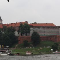
Wien - Krakau, Tag 3
- -:--
- Duration
- 96.8 km
- Distance
- 386 m
- Ascent
- 354 m
- Descent
- ---
- Avg. speed
- ---
- Max. altitude

Part of
Wien - Kraków (2016)
7 stages
Route quality
Waytypes & surfaces along the route
Waytypes
Busy road
43 km
(44 %)
Road
28.1 km
(29 %)
Surfaces
Paved
50 km
(52 %)
Unpaved
0.8 km
(<1 %)
Asphalt
48.2 km
(50 %)
Paving stones
1.6 km
(2 %)
Continue with Bikemap
Use, edit, or download this cycling route
You would like to ride Senica - Nová Dubnica or customize it for your own trip? Here is what you can do with this Bikemap route:
Free features
- Save this route as favorite or in collections
- Copy & plan your own version of this route
- Split it into stages to create a multi-day tour
- Sync your route with Garmin or Wahoo
Premium features
Free trial for 3 days, or one-time payment. More about Bikemap Premium.
- Navigate this route on iOS & Android
- Export a GPX / KML file of this route
- Create your custom printout (try it for free)
- Download this route for offline navigation
Discover more Premium features.
Get Bikemap PremiumFrom our community
Other popular routes starting in Senica
 SE – BA
- Distance
- 106.2 km
- Ascent
- 1,276 m
- Descent
- 1,346 m
- Location
- Senica, Trnava Region, Slovakia
 kpcovita trasa
- Distance
- 20 km
- Ascent
- 307 m
- Descent
- 109 m
- Location
- Senica, Trnava Region, Slovakia
 malý okruh Jablonica
- Distance
- 28.6 km
- Ascent
- 562 m
- Descent
- 560 m
- Location
- Senica, Trnava Region, Slovakia
 Senica - Kunov - Sobotište - Rohov
- Distance
- 20.6 km
- Ascent
- 117 m
- Descent
- 119 m
- Location
- Senica, Trnava Region, Slovakia
 1126, Lopašov do Chropov
- Distance
- 22.9 km
- Ascent
- 236 m
- Descent
- 258 m
- Location
- Senica, Trnava Region, Slovakia
 Podbranc-Myjava-Javorina-Bradlo
- Distance
- 95.9 km
- Ascent
- 1,451 m
- Descent
- 1,453 m
- Location
- Senica, Trnava Region, Slovakia
 Senica - Rozhľadňa Žalostiná
- Distance
- 21.7 km
- Ascent
- 490 m
- Descent
- 79 m
- Location
- Senica, Trnava Region, Slovakia
 B05 Karpatsky prechod
- Distance
- 57.5 km
- Ascent
- 991 m
- Descent
- 1,072 m
- Location
- Senica, Trnava Region, Slovakia
Open it in the app