

My TNGA 2016
A cycling route starting in Walhalla, South Carolina, United States of America.
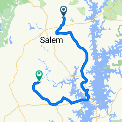
Overview
About this route
Started out on the TNGA route and scrapped it and made my own version with a mix of gravel and road. South Carolina/Georgia border to Dalton, GA
- -:--
- Duration
- 269.1 km
- Distance
- 1,304 m
- Ascent
- 1,538 m
- Descent
- ---
- Avg. speed
- ---
- Max. altitude

Route quality
Waytypes & surfaces along the route
Waytypes
Road
100 km
(37 %)
Cycleway
69.8 km
(26 %)
Surfaces
Paved
123.8 km
(46 %)
Unpaved
26.3 km
(10 %)
Asphalt
123.3 km
(46 %)
Gravel
25.4 km
(9 %)
Continue with Bikemap
Use, edit, or download this cycling route
You would like to ride My TNGA 2016 or customize it for your own trip? Here is what you can do with this Bikemap route:
Free features
- Save this route as favorite or in collections
- Copy & plan your own version of this route
- Split it into stages to create a multi-day tour
- Sync your route with Garmin or Wahoo
Premium features
Free trial for 3 days, or one-time payment. More about Bikemap Premium.
- Navigate this route on iOS & Android
- Export a GPX / KML file of this route
- Create your custom printout (try it for free)
- Download this route for offline navigation
Discover more Premium features.
Get Bikemap PremiumFrom our community
Other popular routes starting in Walhalla
 Shack Hollow Rd, Salem to Oconee Creek Rd, Walhalla
- Distance
- 30.7 km
- Ascent
- 406 m
- Descent
- 479 m
- Location
- Walhalla, South Carolina, United States of America
 ToA19 v2 Greenville
- Distance
- 88.8 km
- Ascent
- 386 m
- Descent
- 415 m
- Location
- Walhalla, South Carolina, United States of America
 Jenny’s lake loop
- Distance
- 14.6 km
- Ascent
- 200 m
- Descent
- 195 m
- Location
- Walhalla, South Carolina, United States of America
 Trans North Georgia 2015
- Distance
- 485.6 km
- Ascent
- 4,162 m
- Descent
- 4,461 m
- Location
- Walhalla, South Carolina, United States of America
 TNGA 2021 1.0
- Distance
- 575.9 km
- Ascent
- 15,041 m
- Descent
- 15,239 m
- Location
- Walhalla, South Carolina, United States of America
 Trans North Georgia Trail
- Distance
- 545 km
- Ascent
- 3,645 m
- Descent
- 3,849 m
- Location
- Walhalla, South Carolina, United States of America
 picket to cashiers
- Distance
- 101.3 km
- Ascent
- 1,180 m
- Descent
- 1,180 m
- Location
- Walhalla, South Carolina, United States of America
 Cracking ride in Walhalla
- Distance
- 22.9 km
- Ascent
- 412 m
- Descent
- 336 m
- Location
- Walhalla, South Carolina, United States of America
Open it in the app