

Ostertal - Kuseler Land
A cycling route starting in Frohnhofen, Rhineland-Palatinate, Germany.
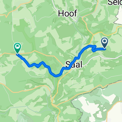
Overview
About this route
Relatively light traffic on Sundays. Initially little gradient. Short climbs in Liebsthal and after Ehweiler. More traffic on the 420.
- -:--
- Duration
- 79 km
- Distance
- 819 m
- Ascent
- 830 m
- Descent
- ---
- Avg. speed
- 396 m
- Max. altitude
Route quality
Waytypes & surfaces along the route
Waytypes
Road
19.7 km
(25 %)
Quiet road
6.3 km
(8 %)
Surfaces
Paved
65.6 km
(83 %)
Unpaved
1.6 km
(2 %)
Asphalt
58.4 km
(74 %)
Paved (undefined)
7.1 km
(9 %)
Continue with Bikemap
Use, edit, or download this cycling route
You would like to ride Ostertal - Kuseler Land or customize it for your own trip? Here is what you can do with this Bikemap route:
Free features
- Save this route as favorite or in collections
- Copy & plan your own version of this route
- Sync your route with Garmin or Wahoo
Premium features
Free trial for 3 days, or one-time payment. More about Bikemap Premium.
- Navigate this route on iOS & Android
- Export a GPX / KML file of this route
- Create your custom printout (try it for free)
- Download this route for offline navigation
Discover more Premium features.
Get Bikemap PremiumFrom our community
Other popular routes starting in Frohnhofen
 Niederkircher Straße 12, St. Wendel nach Jakob-Stoll-Straße 23A, St. Wendel
- Distance
- 12.7 km
- Ascent
- 172 m
- Descent
- 199 m
- Location
- Frohnhofen, Rhineland-Palatinate, Germany
 Entenweiher
- Distance
- 14.7 km
- Ascent
- 241 m
- Descent
- 241 m
- Location
- Frohnhofen, Rhineland-Palatinate, Germany
 St Wendeler Straße 51, Frohnhofen nach Hauptstraße 14, Mittelbrunn
- Distance
- 27.2 km
- Ascent
- 356 m
- Descent
- 381 m
- Location
- Frohnhofen, Rhineland-Palatinate, Germany
 Niederkircher Straße 13, St. Wendel nach Heisterberger Straße 14, Namborn
- Distance
- 15.2 km
- Ascent
- 335 m
- Descent
- 273 m
- Location
- Frohnhofen, Rhineland-Palatinate, Germany
 St. Wendel nach L 307, St. Wendel
- Distance
- 7.4 km
- Ascent
- 137 m
- Descent
- 168 m
- Location
- Frohnhofen, Rhineland-Palatinate, Germany
 Ebereschenstraße 2, St. Wendel nach Hauptstraße 7, Quirnbach/Pfalz
- Distance
- 15.4 km
- Ascent
- 300 m
- Descent
- 370 m
- Location
- Frohnhofen, Rhineland-Palatinate, Germany
 Niederkircher Straße 14, St. Wendel nach Niederkircher Straße 15, St. Wendel
- Distance
- 7.2 km
- Ascent
- 125 m
- Descent
- 127 m
- Location
- Frohnhofen, Rhineland-Palatinate, Germany
 Brunnenradlertour
- Distance
- 81.2 km
- Ascent
- 855 m
- Descent
- 826 m
- Location
- Frohnhofen, Rhineland-Palatinate, Germany
Open it in the app