From Troon to Culzean Castle and Home
- 113.2 km
- 2,287 m
- 2,347 m
- Troon, Scotland, United Kingdom
A cycling route starting in Troon, Scotland, United Kingdom.
Overview
Troon to Kilwinning
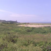
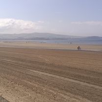
This 22nd section of St Ninian’s way starts at Troon Old Parish Church . Go South along West Portland Street to the coast and pick up the Ayrshire Coastal Path (ACP) after 100 m. Proceed west to the point (2km) and then back East along the marina to Barassie Sands (4 km) . Turn East off ACP onto marked track . Pass under two railway bridges (400m), then under A68 (1.3km). Rejoin ACP and proceed to bridge back over the A78 (2.5km). Follow ACP past the Gailes Marsh Nature Reserve (1km) towards Irvine and track junction (2km) , veer right (North along track until it rejoins ACP (1 km) . Continue through Irvine past the Scottish Maritime Museum and underneath the railway(1km)) and across footbridge over the River Irvine (500 m). Then proceed North along ACP and cross the river Garnock (3 km) and through the tunnel under the A78 . Continue along ACP path beside the Garnock into Kilwinning and arrive at the ruins of the old abbey (2 km). A detailed route description with grid references is available on the Whithorn website below.
Flattish but with great variation.
Also part of the Whithorn Way - http://www.whithornway.org . courtesy of the WWSG where a detailed route description with grid references is available.
For a map overview of Part 1 and Part 2 of St Ninian’s Way please go to https://www.bikemap.net/en/route/3548129-st-ninians-way-carlisle-to-st-andrews-part-1-carlisle-to-whithorn/
St Ninian’s Way is one of the great pilgrim routes in Scotland to St Andrews - The Way of St Andrews - For other routes see http://www.thewayofstandrews.com
created this 9 years ago
Route quality
Cycleway
15.1 km
(75 %)
Quiet road
3 km
(15 %)
Paved
14.7 km
(73 %)
Asphalt
14.7 km
(73 %)
Undefined
5.4 km
(27 %)
Route highlights
Troon Old Parish Church
Gailes Marsh Nature Reserve
Scottish Maritime Museum
Continue with Bikemap
You would like to ride St Ninian's Way- Troon to Kilwinning or customize it for your own trip? Here is what you can do with this Bikemap route:
Free trial for 3 days, or one-time payment. More about Bikemap Premium.
Discover more Premium features.
Get Bikemap PremiumFrom our community
Open it in the app