
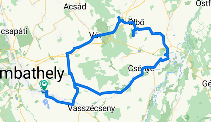
Olboi to
A cycling route starting in Táplánszentkereszt, Vas, Hungary.
Overview
About this route
Szombathelyrol Tanakajd es Pecol fele Megyehidig, Megyehid es Csenye kozott foldut. Majd Sarvar, Rabasomjen, es OLBOI HORGASZTO !
Olborol Szeleste, kastely, Vati szentkut, Vep, Tanakajd, vissza Szombathely.
- -:--
- Duration
- 70.5 km
- Distance
- 68 m
- Ascent
- 69 m
- Descent
- ---
- Avg. speed
- ---
- Max. altitude

Route photos


Route quality
Waytypes & surfaces along the route
Waytypes
Busy road
37.7 km
(54 %)
Quiet road
12.5 km
(18 %)
Surfaces
Paved
28.8 km
(41 %)
Unpaved
4 km
(6 %)
Asphalt
28.8 km
(41 %)
Ground
1.9 km
(3 %)
Continue with Bikemap
Use, edit, or download this cycling route
You would like to ride Olboi to or customize it for your own trip? Here is what you can do with this Bikemap route:
Free features
- Save this route as favorite or in collections
- Copy & plan your own version of this route
- Sync your route with Garmin or Wahoo
Premium features
Free trial for 3 days, or one-time payment. More about Bikemap Premium.
- Navigate this route on iOS & Android
- Export a GPX / KML file of this route
- Create your custom printout (try it for free)
- Download this route for offline navigation
Discover more Premium features.
Get Bikemap PremiumFrom our community
Other popular routes starting in Táplánszentkereszt
 Szentkirály-Bozsok
- Distance
- 37.3 km
- Ascent
- 350 m
- Descent
- 348 m
- Location
- Táplánszentkereszt, Vas, Hungary
 Szentkirály-Sé-Bucsu-Szentkirály
- Distance
- 48.6 km
- Ascent
- 146 m
- Descent
- 192 m
- Location
- Táplánszentkereszt, Vas, Hungary
 Hegykerules Jozsival
- Distance
- 106.2 km
- Ascent
- 474 m
- Descent
- 473 m
- Location
- Táplánszentkereszt, Vas, Hungary
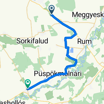
 Rákóczi Ferenc utca 20, Vasszécseny to Rákóczi Ferenc utca 20, Vasszécseny
- Distance
- 8.4 km
- Ascent
- 61 m
- Descent
- 69 m
- Location
- Táplánszentkereszt, Vas, Hungary
 Vasarnapi karika
- Distance
- 81.4 km
- Ascent
- 269 m
- Descent
- 269 m
- Location
- Táplánszentkereszt, Vas, Hungary
 PANTÉR - VHR
- Distance
- 18.4 km
- Ascent
- 13 m
- Descent
- 16 m
- Location
- Táplánszentkereszt, Vas, Hungary
 VELOREGIO_12.
- Distance
- 28.1 km
- Ascent
- 33 m
- Descent
- 33 m
- Location
- Táplánszentkereszt, Vas, Hungary
 E-bike túra Szombathelyről...
- Distance
- 36.4 km
- Ascent
- 30 m
- Descent
- 30 m
- Location
- Táplánszentkereszt, Vas, Hungary
Open it in the app