

zaid
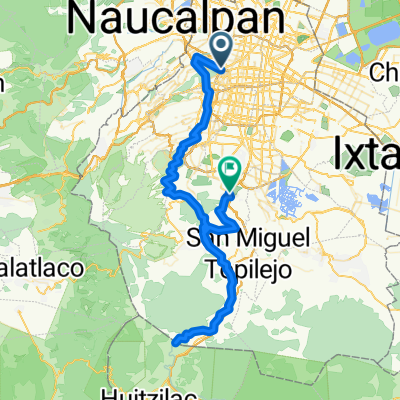
A cycling route starting in Polanco, Mexico City, Mexico.
Overview
About this route
- -:--
- Duration
- 12.1 km
- Distance
- 136 m
- Ascent
- 136 m
- Descent
- ---
- Avg. speed
- ---
- Max. altitude

Continue with Bikemap
Use, edit, or download this cycling route
You would like to ride zaid or customize it for your own trip? Here is what you can do with this Bikemap route:
Free features
- Save this route as favorite or in collections
- Copy & plan your own version of this route
- Sync your route with Garmin or Wahoo
Premium features
Free trial for 3 days, or one-time payment. More about Bikemap Premium.
- Navigate this route on iOS & Android
- Export a GPX / KML file of this route
- Create your custom printout (try it for free)
- Download this route for offline navigation
Discover more Premium features.
Get Bikemap PremiumFrom our community
Other popular routes starting in Polanco
 CDMX nights
- Distance
- 17 km
- Ascent
- 615 m
- Descent
- 617 m
- Location
- Polanco, Mexico City, Mexico
 Diana Cazadora - Centro Ceremonial Otomí
- Distance
- 64.7 km
- Ascent
- 1,535 m
- Descent
- 582 m
- Location
- Polanco, Mexico City, Mexico
 Ciclopista Ferrocarril de Cuernavaca CLONED FROM ROUTE 1720879
- Distance
- 90.7 km
- Ascent
- 832 m
- Descent
- 774 m
- Location
- Polanco, Mexico City, Mexico
 Recording from May 10, 2017, 1:47 PM
- Distance
- 7.1 km
- Ascent
- 34 m
- Descent
- 77 m
- Location
- Polanco, Mexico City, Mexico
 Recovered Route
- Distance
- 4.1 km
- Ascent
- 2,784 m
- Descent
- 2,769 m
- Location
- Polanco, Mexico City, Mexico
 Citta del Messico - Paseo della Riforma
- Distance
- 16.2 km
- Ascent
- 118 m
- Descent
- 117 m
- Location
- Polanco, Mexico City, Mexico
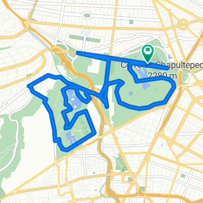
 Chapultepec CDMX
- Distance
- 8.8 km
- Ascent
- 122 m
- Descent
- 125 m
- Location
- Polanco, Mexico City, Mexico
 Lago mayor de Chapultepec
- Distance
- 5 km
- Ascent
- 46 m
- Descent
- 47 m
- Location
- Polanco, Mexico City, Mexico
Open it in the app