

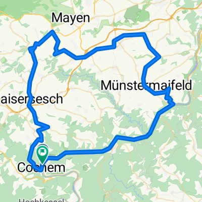
Moselradweg Trier - Koblenz, 4. Tag (ohne Deutsches Eck)
A cycling route starting in Cochem, Rhineland-Palatinate, Germany.
Overview
About this route
- -:--
- Duration
- 48.6 km
- Distance
- 348 m
- Ascent
- 276 m
- Descent
- ---
- Avg. speed
- ---
- Max. altitude
Route quality
Waytypes & surfaces along the route
Waytypes
Track
8.3 km
(17 %)
Quiet road
5.3 km
(11 %)
Surfaces
Paved
35 km
(72 %)
Unpaved
6.3 km
(13 %)
Asphalt
35 km
(72 %)
Unpaved (undefined)
3.9 km
(8 %)
Route highlights
Points of interest along the route
Point of interest after 0 km
Moseltal-Jugendherberge Klottener Straße 9 56812 Cochem Tel.: +49 2671 8633
Point of interest after 24.1 km
Fährturm 56332 Hatzenport
Point of interest after 28.9 km
Burg Thurant 56332 Alken/Mosel Tel.: +49 2605 2004
Point of interest after 48.6 km
Kaiser-Wilhelm-Denkmal 56068 Koblenz
Point of interest after 48.6 km
Kurfürstliches Schloss 56068 Koblenz
Point of interest after 48.6 km
Deutsches Eck 56068 Koblenz
Point of interest after 48.6 km
Koblenz Hbf Bahnhofsplatz 2 56068 Koblenz
Point of interest after 48.6 km
Talstation der Seilbahn zur Festung Ehrenbreitstein Konrad-Adenauer-Ufer 56068 Koblenz Tel.: +49 261 / 2016585-0
Continue with Bikemap
Use, edit, or download this cycling route
You would like to ride Moselradweg Trier - Koblenz, 4. Tag (ohne Deutsches Eck) or customize it for your own trip? Here is what you can do with this Bikemap route:
Free features
- Save this route as favorite or in collections
- Copy & plan your own version of this route
- Sync your route with Garmin or Wahoo
Premium features
Free trial for 3 days, or one-time payment. More about Bikemap Premium.
- Navigate this route on iOS & Android
- Export a GPX / KML file of this route
- Create your custom printout (try it for free)
- Download this route for offline navigation
Discover more Premium features.
Get Bikemap PremiumFrom our community
Other popular routes starting in Cochem
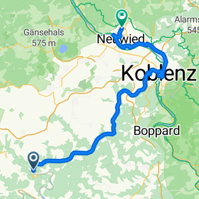 Tag8 Von Cochem bis Neuwied
- Distance
- 82.8 km
- Ascent
- 733 m
- Descent
- 739 m
- Location
- Cochem, Rhineland-Palatinate, Germany
 Cochem nach Cochem 2 (84Km)
- Distance
- 84.1 km
- Ascent
- 804 m
- Descent
- 804 m
- Location
- Cochem, Rhineland-Palatinate, Germany
 Van Cochem naar Burg Eltz
- Distance
- 19.9 km
- Ascent
- 239 m
- Descent
- 200 m
- Location
- Cochem, Rhineland-Palatinate, Germany
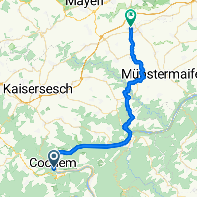
 From Cochem to Niederfell
- Distance
- 35.1 km
- Ascent
- 355 m
- Descent
- 368 m
- Location
- Cochem, Rhineland-Palatinate, Germany
 Cochem nach Cochem 2 (84Km)
- Distance
- 84.1 km
- Ascent
- 804 m
- Descent
- 804 m
- Location
- Cochem, Rhineland-Palatinate, Germany
 Moderate Samstag Ride In Cochem
- Distance
- 23.9 km
- Ascent
- 371 m
- Descent
- 369 m
- Location
- Cochem, Rhineland-Palatinate, Germany
 Cochem - Polch
- Distance
- 31.8 km
- Ascent
- 529 m
- Descent
- 406 m
- Location
- Cochem, Rhineland-Palatinate, Germany
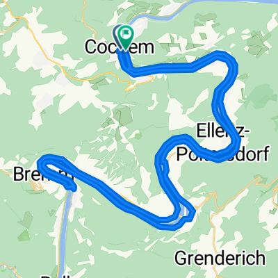 Sterntour rund um Cochem - Tour 1: Rundtour auf dem Mosel-Radwegüber Bremm nach Cochem
- Distance
- 53.6 km
- Ascent
- 569 m
- Descent
- 557 m
- Location
- Cochem, Rhineland-Palatinate, Germany
Open it in the app