

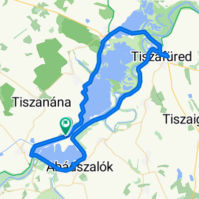
Tisza Tó kerülés
A cycling route starting in Abádszalók, Jász-Nagykun-Szolnok, Hungary.
Overview
About this route
Tisza Lake Loop
- -:--
- Duration
- 63.8 km
- Distance
- 34 m
- Ascent
- 37 m
- Descent
- ---
- Avg. speed
- ---
- Max. altitude
Route quality
Waytypes & surfaces along the route
Waytypes
Access road
53.6 km
(84 %)
Quiet road
2.6 km
(4 %)
Surfaces
Paved
58 km
(91 %)
Unpaved
0.6 km
(1 %)
Asphalt
57.4 km
(90 %)
Concrete
0.6 km
(1 %)
Route highlights
Points of interest along the route

Point of interest after 58.7 km
POI Description
Continue with Bikemap
Use, edit, or download this cycling route
You would like to ride Tisza Tó kerülés or customize it for your own trip? Here is what you can do with this Bikemap route:
Free features
- Save this route as favorite or in collections
- Copy & plan your own version of this route
- Sync your route with Garmin or Wahoo
Premium features
Free trial for 3 days, or one-time payment. More about Bikemap Premium.
- Navigate this route on iOS & Android
- Export a GPX / KML file of this route
- Create your custom printout (try it for free)
- Download this route for offline navigation
Discover more Premium features.
Get Bikemap PremiumFrom our community
Other popular routes starting in Abádszalók
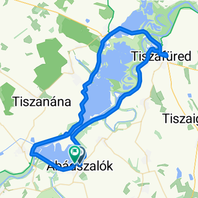
 Tisza-tó nagy kör
- Distance
- 96.2 km
- Ascent
- 12 m
- Descent
- 9 m
- Location
- Abádszalók, Jász-Nagykun-Szolnok, Hungary
 Magyarország - Magyarország
- Distance
- 68.2 km
- Ascent
- 53 m
- Descent
- 54 m
- Location
- Abádszalók, Jász-Nagykun-Szolnok, Hungary
 Tisza Tó kerülés
- Distance
- 63.8 km
- Ascent
- 34 m
- Descent
- 37 m
- Location
- Abádszalók, Jász-Nagykun-Szolnok, Hungary
 Abádszalók to Abádszalók
- Distance
- 66.7 km
- Ascent
- 64 m
- Descent
- 63 m
- Location
- Abádszalók, Jász-Nagykun-Szolnok, Hungary
 Móra Ferenc út - Damjanich út
- Distance
- 84.1 km
- Ascent
- 68 m
- Descent
- 67 m
- Location
- Abádszalók, Jász-Nagykun-Szolnok, Hungary
 BWE - 1 - Abadszalok - Patkos Csarda
- Distance
- 48.9 km
- Ascent
- 15 m
- Descent
- 13 m
- Location
- Abádszalók, Jász-Nagykun-Szolnok, Hungary
 Strand út - Strand út
- Distance
- 64.7 km
- Ascent
- 123 m
- Descent
- 171 m
- Location
- Abádszalók, Jász-Nagykun-Szolnok, Hungary
 Abádszalók - Tiszafured
- Distance
- 25 km
- Ascent
- 13 m
- Descent
- 11 m
- Location
- Abádszalók, Jász-Nagykun-Szolnok, Hungary
Open it in the app