

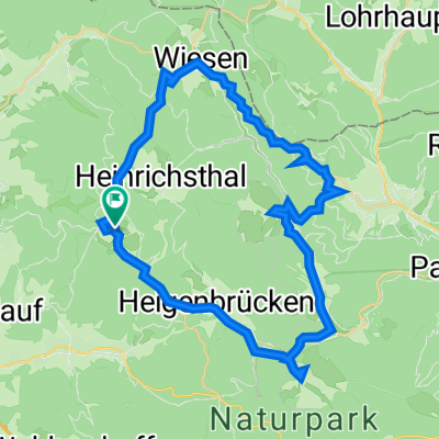
Eselsweg vom Engländer nach MIL
A cycling route starting in Heinrichsthal, Bavaria, Germany.
Overview
About this route
Eselsweg, vom Engländer bis nach Miltenberg zum Biergarten Parkhof, Altstadtweg 8
(62km, 820m Höhe)
- -:--
- Duration
- 62.1 km
- Distance
- 721 m
- Ascent
- 1,058 m
- Descent
- ---
- Avg. speed
- ---
- Max. altitude

Continue with Bikemap
Use, edit, or download this cycling route
You would like to ride Eselsweg vom Engländer nach MIL or customize it for your own trip? Here is what you can do with this Bikemap route:
Free features
- Save this route as favorite or in collections
- Copy & plan your own version of this route
- Sync your route with Garmin or Wahoo
Premium features
Free trial for 3 days, or one-time payment. More about Bikemap Premium.
- Navigate this route on iOS & Android
- Export a GPX / KML file of this route
- Create your custom printout (try it for free)
- Download this route for offline navigation
Discover more Premium features.
Get Bikemap PremiumFrom our community
Other popular routes starting in Heinrichsthal
 Spessart Frammersbach 36km 620hm
- Distance
- 36.4 km
- Ascent
- 579 m
- Descent
- 581 m
- Location
- Heinrichsthal, Bavaria, Germany
 31.5.18
- Distance
- 12.9 km
- Ascent
- 128 m
- Descent
- 130 m
- Location
- Heinrichsthal, Bavaria, Germany
 Im Gründchen 7, Heigenbrücken nach Im Gründchen 9, Heigenbrücken
- Distance
- 42 km
- Ascent
- 620 m
- Descent
- 614 m
- Location
- Heinrichsthal, Bavaria, Germany
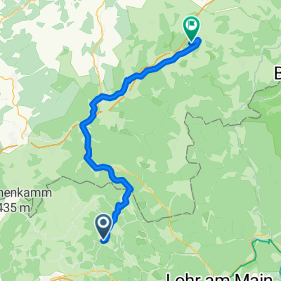 Eselsweg 1. Teil
- Distance
- 55.4 km
- Ascent
- 476 m
- Descent
- 686 m
- Location
- Heinrichsthal, Bavaria, Germany
 AB19, Aschaffenburg, gemeindefreies Gebiet nach Hauptstraße 30, Stockstadt am Main
- Distance
- 24.3 km
- Ascent
- 108 m
- Descent
- 460 m
- Location
- Heinrichsthal, Bavaria, Germany
 Zum Engländer
- Distance
- 52.3 km
- Ascent
- 161 m
- Descent
- 559 m
- Location
- Heinrichsthal, Bavaria, Germany
 Eselsweg vom Engländer nach MIL
- Distance
- 62.1 km
- Ascent
- 721 m
- Descent
- 1,058 m
- Location
- Heinrichsthal, Bavaria, Germany
 Engländer- Langenselbold
- Distance
- 30.2 km
- Ascent
- 274 m
- Descent
- 614 m
- Location
- Heinrichsthal, Bavaria, Germany
Open it in the app