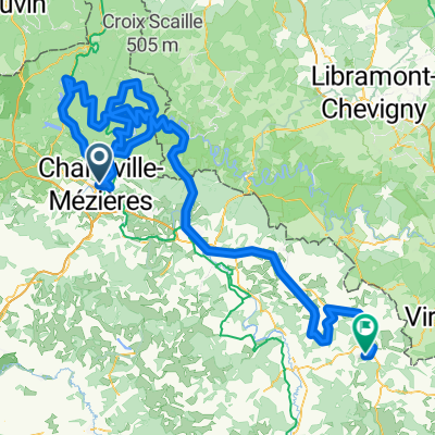
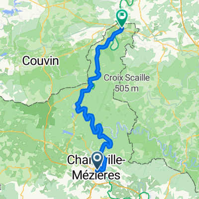
Charleville-Mézieres Rance
A cycling route starting in Charleville-Mézières, Grand Est, France.
Overview
About this route
La voie verte is very nice along the Meuse. The ascent until Arreux is quite long and not so interesting as you go through the forest. The road through Houldizy seemed to have a clear view on the surroundings so I would recommend the ascent through Houldizy.
Then you go through very nice villages with houses made of stone.
You can stop in Rocroi, it has a very nice citadel to see.
Between Rocroi and Cul des sarts, nothing special. Countryside.
The road between Cul des Sarts and Baileux is very nice! It goes through forest and country side. Then you can stop in Chimay, very nice city to stop. Then you catch the Ravel L109, which is very nice, all forest.
All roads in good conditions.
- -:--
- Duration
- 78.1 km
- Distance
- 473 m
- Ascent
- 397 m
- Descent
- ---
- Avg. speed
- ---
- Max. altitude
Route quality
Waytypes & surfaces along the route
Waytypes
Road
42.2 km
(54 %)
Cycleway
18 km
(23 %)
Surfaces
Paved
56.2 km
(72 %)
Asphalt
56.2 km
(72 %)
Undefined
21.9 km
(28 %)
Continue with Bikemap
Use, edit, or download this cycling route
You would like to ride Charleville-Mézieres Rance or customize it for your own trip? Here is what you can do with this Bikemap route:
Free features
- Save this route as favorite or in collections
- Copy & plan your own version of this route
- Sync your route with Garmin or Wahoo
Premium features
Free trial for 3 days, or one-time payment. More about Bikemap Premium.
- Navigate this route on iOS & Android
- Export a GPX / KML file of this route
- Create your custom printout (try it for free)
- Download this route for offline navigation
Discover more Premium features.
Get Bikemap PremiumFrom our community
Other popular routes starting in Charleville-Mézières
- ride retro 2012
- Distance
- 31.5 km
- Ascent
- 201 m
- Descent
- 221 m
- Location
- Charleville-Mézières, Grand Est, France
- Charleville-Mézieres Rance
- Distance
- 78.1 km
- Ascent
- 473 m
- Descent
- 397 m
- Location
- Charleville-Mézières, Grand Est, France
- 02 Charleville - Monthermé - Givet
- Distance
- 79.1 km
- Ascent
- 289 m
- Descent
- 334 m
- Location
- Charleville-Mézières, Grand Est, France
- d7 - Emik 2022
- Distance
- 80.8 km
- Ascent
- 709 m
- Descent
- 756 m
- Location
- Charleville-Mézières, Grand Est, France
- FA22 Dinant
- Distance
- 107.1 km
- Ascent
- 155 m
- Descent
- 196 m
- Location
- Charleville-Mézières, Grand Est, France
- 2019-5-L- 4. Etappe
- Distance
- 162.5 km
- Ascent
- 1,121 m
- Descent
- 808 m
- Location
- Charleville-Mézières, Grand Est, France
- Charleville-Mezieres to Inor
- Distance
- 75.1 km
- Ascent
- 462 m
- Descent
- 436 m
- Location
- Charleville-Mézières, Grand Est, France
- Bouillon1
- Distance
- 60.7 km
- Ascent
- 620 m
- Descent
- 437 m
- Location
- Charleville-Mézières, Grand Est, France
Open it in the app