

Bierquellenwanderweg Lindenhardt - Leups - Büchenbach -
A cycling route starting in Pegnitz, Bavaria, Germany.
Overview
About this route
This hiking trail offers a great opportunity to taste beers from four small Franconian breweries along a scenic route. Since it is a circular trail, hikers can start at any of the four 'beer sources'.
Brief description of the individual stages:
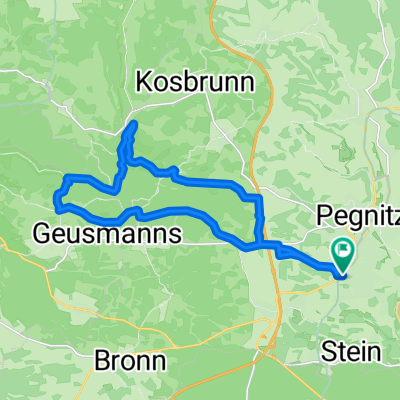
• Weiglathal – Lindenhardt Starting from the Übelhack Brewery (closed Mondays) in Weiglathal, our path leads 3.2 km through the Lindenhardt forest past the Seven Springs to Lindenhardt. • Lindenhardt – Leups From the Kürzdörfer Brewery (closed Mondays) in Lindenhardt (worth seeing: 14th-century parish church with Grünewald altar and paintings by Mathias Grünewald), the 3 km path passes by the Leups mill to Leups. • Leups – Büchenbach From the Gradl Brewery (closed Tuesdays) in Leups, the path leads 4.2 km past the Eichetsbühl (519 m) to Kaltenthal and along the valley to Büchenbach. • Büchenbach – Weiglathal Starting at the Herold Brewery (closed Tuesdays) in Büchenbach, the path takes us over the Rupprechtshöhe and Bodendorf to Trockau and then back to Weiglathal (10.9 km). Hikers who find the route too long can shorten the trail into two stages (north and south loops) by using the path from Leups to Trockau.
- -:--
- Duration
- 19.8 km
- Distance
- 481 m
- Ascent
- 481 m
- Descent
- ---
- Avg. speed
- ---
- Max. altitude
Route quality
Waytypes & surfaces along the route
Waytypes
Track
8.1 km
(41 %)
Quiet road
7.7 km
(39 %)
Surfaces
Paved
7.1 km
(36 %)
Unpaved
6.5 km
(33 %)
Asphalt
5.4 km
(27 %)
Ground
3.6 km
(18 %)
Route highlights
Points of interest along the route
Point of interest after 2.4 km
Brauerei Gasthof Gradl
Point of interest after 5.4 km
Brauerei Gasthof Kurzdörfer
Point of interest after 8.4 km
Brauerei Übelhack
Point of interest after 18.5 km
Gasthof Herold
Continue with Bikemap
Use, edit, or download this cycling route
You would like to ride Bierquellenwanderweg Lindenhardt - Leups - Büchenbach - or customize it for your own trip? Here is what you can do with this Bikemap route:
Free features
- Save this route as favorite or in collections
- Copy & plan your own version of this route
- Sync your route with Garmin or Wahoo
Premium features
Free trial for 3 days, or one-time payment. More about Bikemap Premium.
- Navigate this route on iOS & Android
- Export a GPX / KML file of this route
- Create your custom printout (try it for free)
- Download this route for offline navigation
Discover more Premium features.
Get Bikemap PremiumFrom our community
Other popular routes starting in Pegnitz
 Runde nach Königsstein
- Distance
- 56.6 km
- Ascent
- 521 m
- Descent
- 518 m
- Location
- Pegnitz, Bavaria, Germany
 Pegnitz - Wander
- Distance
- 4 km
- Ascent
- 117 m
- Descent
- 115 m
- Location
- Pegnitz, Bavaria, Germany
 Pegnitz - Bayreuth
- Distance
- 90.7 km
- Ascent
- 570 m
- Descent
- 652 m
- Location
- Pegnitz, Bavaria, Germany
 Veldensteiner Forst - Burg Hartenstein
- Distance
- 48.7 km
- Ascent
- 590 m
- Descent
- 587 m
- Location
- Pegnitz, Bavaria, Germany
 Pegnitz Weidlwang Horlach
- Distance
- 20.6 km
- Ascent
- 244 m
- Descent
- 243 m
- Location
- Pegnitz, Bavaria, Germany
 Bronn-Michelfeld
- Distance
- 10.7 km
- Ascent
- 162 m
- Descent
- 176 m
- Location
- Pegnitz, Bavaria, Germany
 Pegnitz-Weiglathal-Leups-Pegnitz
- Distance
- 55.8 km
- Ascent
- 788 m
- Descent
- 786 m
- Location
- Pegnitz, Bavaria, Germany
 Rundweg Pegnitz Elbersberg Hollenberg
- Distance
- 19.2 km
- Ascent
- 332 m
- Descent
- 332 m
- Location
- Pegnitz, Bavaria, Germany
Open it in the app