

Niederfellendorf_Behringersmühle_Pfaffenstein_Quackenschloß_Adlerstein_Riesenburg_und zurück
A cycling route starting in Unterleinleiter, Bavaria, Germany.
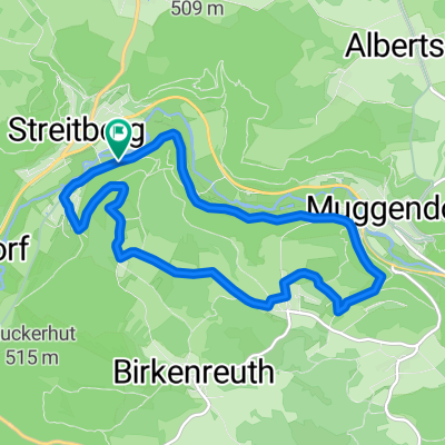
Overview
About this route
Beautiful MTB tour starting in Niederfellendorf from the outdoor swimming pool to Behringersmühle, then climbing up towards Moritz and Engelhardsberg and from there descending back into the Wiesent valley, continuing towards Behringersmühle and halfway back again to Wölm and Moritz, then down again into the Wiesent valley and back to Niederfellendorf. Cool climbs and descents.
- -:--
- Duration
- 35.1 km
- Distance
- 625 m
- Ascent
- 625 m
- Descent
- ---
- Avg. speed
- ---
- Max. altitude

Continue with Bikemap
Use, edit, or download this cycling route
You would like to ride Niederfellendorf_Behringersmühle_Pfaffenstein_Quackenschloß_Adlerstein_Riesenburg_und zurück or customize it for your own trip? Here is what you can do with this Bikemap route:
Free features
- Save this route as favorite or in collections
- Copy & plan your own version of this route
- Sync your route with Garmin or Wahoo
Premium features
Free trial for 3 days, or one-time payment. More about Bikemap Premium.
- Navigate this route on iOS & Android
- Export a GPX / KML file of this route
- Create your custom printout (try it for free)
- Download this route for offline navigation
Discover more Premium features.
Get Bikemap PremiumFrom our community
Other popular routes starting in Unterleinleiter
 2. Tag
- Distance
- 49.1 km
- Ascent
- 588 m
- Descent
- 588 m
- Location
- Unterleinleiter, Bavaria, Germany
 Rund um die Neideck
- Distance
- 9.4 km
- Ascent
- 445 m
- Descent
- 445 m
- Location
- Unterleinleiter, Bavaria, Germany
 Ruine_Neideck_Muschelquelle_Oswaldhöhle_Adlerstein
- Distance
- 22.1 km
- Ascent
- 649 m
- Descent
- 650 m
- Location
- Unterleinleiter, Bavaria, Germany
 AX Runde
- Distance
- 41.8 km
- Ascent
- 796 m
- Descent
- 796 m
- Location
- Unterleinleiter, Bavaria, Germany
 Muggendorf nach Nordenok
- Distance
- 101.2 km
- Ascent
- 709 m
- Descent
- 709 m
- Location
- Unterleinleiter, Bavaria, Germany
 2017_06 MTB: Zuckerhut
- Distance
- 28.7 km
- Ascent
- 549 m
- Descent
- 548 m
- Location
- Unterleinleiter, Bavaria, Germany
 FS-2Tälertour
- Distance
- 48.6 km
- Ascent
- 609 m
- Descent
- 609 m
- Location
- Unterleinleiter, Bavaria, Germany
 Rund um Muggendorf
- Distance
- 36.5 km
- Ascent
- 569 m
- Descent
- 569 m
- Location
- Unterleinleiter, Bavaria, Germany
Open it in the app