

Grenzgängerroute2016 + Hasequelle
1.Etappe Grenzgängerroute
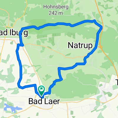
A cycling route starting in Bad Laer, Lower Saxony, Germany.
Overview
About this route
Bad Laer, Hilter, Bad Iburg, Lienen, Glandorf, Ostbevern;
- -:--
- Duration
- 53.8 km
- Distance
- 134 m
- Ascent
- 171 m
- Descent
- ---
- Avg. speed
- ---
- Max. altitude

Part of
Route quality
Waytypes & surfaces along the route
Waytypes
Quiet road
44.1 km
(82 %)
Path
2.7 km
(5 %)
Surfaces
Paved
41.4 km
(77 %)
Unpaved
2.7 km
(5 %)
Asphalt
36 km
(67 %)
Paved (undefined)
5.4 km
(10 %)
Route highlights
Points of interest along the route

Point of interest after 34.3 km
Windmühle

Photo after 34.7 km
Zisterne auf dem Thieplatz

Point of interest after 45 km
Audio-Grenzgängergeschichten

Photo after 50.9 km
Schloss Loburg

Bike service after 53.2 km
Rad Werkstatt

Accommodation after 53.5 km
Hotel Alte Post

Photo after 53.5 km
E-Bike Ladestadion
Continue with Bikemap
Use, edit, or download this cycling route
You would like to ride 1.Etappe Grenzgängerroute or customize it for your own trip? Here is what you can do with this Bikemap route:
Free features
- Save this route as favorite or in collections
- Copy & plan your own version of this route
- Sync your route with Garmin or Wahoo
Premium features
Free trial for 3 days, or one-time payment. More about Bikemap Premium.
- Navigate this route on iOS & Android
- Export a GPX / KML file of this route
- Create your custom printout (try it for free)
- Download this route for offline navigation
Discover more Premium features.
Get Bikemap PremiumFrom our community
Other popular routes starting in Bad Laer
 Kleine Runde
- Distance
- 43.7 km
- Ascent
- 94 m
- Descent
- 94 m
- Location
- Bad Laer, Lower Saxony, Germany
 CE091122
- Distance
- 25.5 km
- Ascent
- 200 m
- Descent
- 200 m
- Location
- Bad Laer, Lower Saxony, Germany
 Rundtour Sassenberg mit einigen See`n
- Distance
- 29 km
- Ascent
- 55 m
- Descent
- 56 m
- Location
- Bad Laer, Lower Saxony, Germany
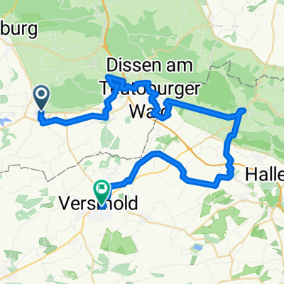 Grenzgängertour 1.Tag
- Distance
- 46 km
- Ascent
- 105 m
- Descent
- 126 m
- Location
- Bad Laer, Lower Saxony, Germany
 Bad Lear über Osnabrück, Hasbergen Lengerich (Friedensroute) zurück nach Bad Laer über Lienen
- Distance
- 79.1 km
- Ascent
- 573 m
- Descent
- 574 m
- Location
- Bad Laer, Lower Saxony, Germany
 Bad Laer nach Vinnenberg, Bad Laer
- Distance
- 43.7 km
- Ascent
- 69 m
- Descent
- 69 m
- Location
- Bad Laer, Lower Saxony, Germany
 Bad Laer-Bad Iburg-Bad Rothenfelde-Bad Laer
- Distance
- 35.4 km
- Ascent
- 183 m
- Descent
- 183 m
- Location
- Bad Laer, Lower Saxony, Germany
 Dinkelhof - Füchtorf, Glandorf
- Distance
- 32.5 km
- Ascent
- 43 m
- Descent
- 43 m
- Location
- Bad Laer, Lower Saxony, Germany
Open it in the app