

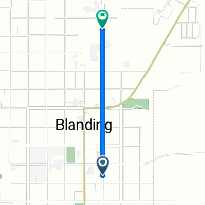
Blanding, UT - Hanksville, UT
A cycling route starting in Blanding, Utah, United States.
Overview
About this route
- -:--
- Duration
- 203 km
- Distance
- 1,289 m
- Ascent
- 1,838 m
- Descent
- ---
- Avg. speed
- ---
- Max. altitude

Route quality
Waytypes & surfaces along the route
Surfaces
Paved
201 km
(99 %)
Asphalt
201 km
(99 %)
Undefined
2 km
(1 %)
Continue with Bikemap
Use, edit, or download this cycling route
You would like to ride Blanding, UT - Hanksville, UT or customize it for your own trip? Here is what you can do with this Bikemap route:
Free features
- Save this route as favorite or in collections
- Copy & plan your own version of this route
- Split it into stages to create a multi-day tour
- Sync your route with Garmin or Wahoo
Premium features
Free trial for 3 days, or one-time payment. More about Bikemap Premium.
- Navigate this route on iOS & Android
- Export a GPX / KML file of this route
- Create your custom printout (try it for free)
- Download this route for offline navigation
Discover more Premium features.
Get Bikemap PremiumFrom our community
Other popular routes starting in Blanding
 Blanding, UT - Hanksville, UT
- Distance
- 202.7 km
- Ascent
- 1,236 m
- Descent
- 1,782 m
- Location
- Blanding, Utah, United States
 E 400 S, Blanding to N Blue Mountain Rd, Blanding
- Distance
- 1.6 km
- Ascent
- 28 m
- Descent
- 0 m
- Location
- Blanding, Utah, United States
 19 Bluff-Tuba City 244
- Distance
- 244 km
- Ascent
- 1,279 m
- Descent
- 1,246 m
- Location
- Blanding, Utah, United States
 US-191, Blanding to Johnson Creek, Blanding
- Distance
- 22.2 km
- Ascent
- 526 m
- Descent
- 151 m
- Location
- Blanding, Utah, United States
 blanding > dolores
- Distance
- 129.8 km
- Ascent
- 867 m
- Descent
- 597 m
- Location
- Blanding, Utah, United States
 Blanding, UT - Hanksville, UT
- Distance
- 203 km
- Ascent
- 1,289 m
- Descent
- 1,838 m
- Location
- Blanding, Utah, United States
 USA 26: Recapture Creek - Somewhere
- Distance
- 110.6 km
- Ascent
- 804 m
- Descent
- 592 m
- Location
- Blanding, Utah, United States
 259-> BLANDING - HITE
- Distance
- 158.4 km
- Ascent
- 1,114 m
- Descent
- 1,845 m
- Location
- Blanding, Utah, United States
Open it in the app