
2016 Ride Day 138 - Le Malzieu-Ville to Le-Puy-en-Velay
A cycling route starting in Le Malzieu-Ville, Occitanie, France.
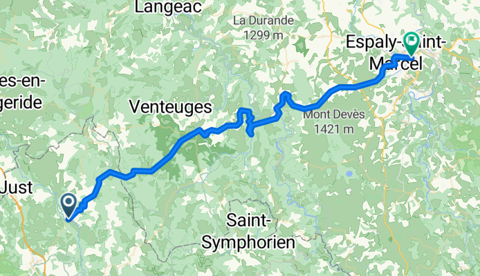
Overview
About this route
Great ride. The first part was on zero traffic roads. Due to rain, we did the second half on a "yellow" road that wasn't bad. It often had some shoulder and not too much traffic.
- -:--
- Duration
- 70.5 km
- Distance
- 1,221 m
- Ascent
- 1,457 m
- Descent
- ---
- Avg. speed
- ---
- Max. altitude

Route photos


Route quality
Waytypes & surfaces along the route
Waytypes
Road
24 km
(34 %)
Quiet road
1.4 km
(2 %)
Surfaces
Paved
29.6 km
(42 %)
Unpaved
0.7 km
(1 %)
Asphalt
29.6 km
(42 %)
Unpaved (undefined)
0.7 km
(1 %)
Undefined
40.2 km
(57 %)
Continue with Bikemap
Use, edit, or download this cycling route
You would like to ride 2016 Ride Day 138 - Le Malzieu-Ville to Le-Puy-en-Velay or customize it for your own trip? Here is what you can do with this Bikemap route:
Free features
- Save this route as favorite or in collections
- Copy & plan your own version of this route
- Sync your route with Garmin or Wahoo
Premium features
Free trial for 3 days, or one-time payment. More about Bikemap Premium.
- Navigate this route on iOS & Android
- Export a GPX / KML file of this route
- Create your custom printout (try it for free)
- Download this route for offline navigation
Discover more Premium features.
Get Bikemap PremiumFrom our community
Other popular routes starting in Le Malzieu-Ville
 Liaison GTMC SCA-Ste Eulalie-SCA
- Distance
- 57.4 km
- Ascent
- 1,192 m
- Descent
- 1,194 m
- Location
- Le Malzieu-Ville, Occitanie, France
 TMC2_St-Chély-d'Apcher - St-Flour
- Distance
- 65.1 km
- Ascent
- 2,134 m
- Descent
- 2,251 m
- Location
- Le Malzieu-Ville, Occitanie, France
 Ardèche-Cévennes-Auvergne_8
- Distance
- 62 km
- Ascent
- 993 m
- Descent
- 1,047 m
- Location
- Le Malzieu-Ville, Occitanie, France
 tape 5 : St Chély d'Apcher-St Germain de Calberte
- Distance
- 188.8 km
- Ascent
- 2,321 m
- Descent
- 2,816 m
- Location
- Le Malzieu-Ville, Occitanie, France
 GTMC 170901
- Distance
- 42.3 km
- Ascent
- 888 m
- Descent
- 589 m
- Location
- Le Malzieu-Ville, Occitanie, France
 Pont de Gabarit château d orfeuillette
- Distance
- 57 km
- Ascent
- 777 m
- Descent
- 737 m
- Location
- Le Malzieu-Ville, Occitanie, France
 8.etapa Le Malzieu-Ville - Le Puy-en-Velay
- Distance
- 72.4 km
- Ascent
- 1,233 m
- Descent
- 1,432 m
- Location
- Le Malzieu-Ville, Occitanie, France
 2004 ツール観戦記 第11ステージ 走行ルート
- Distance
- 513.1 km
- Ascent
- 1,595 m
- Descent
- 2,221 m
- Location
- Le Malzieu-Ville, Occitanie, France
Open it in the app