

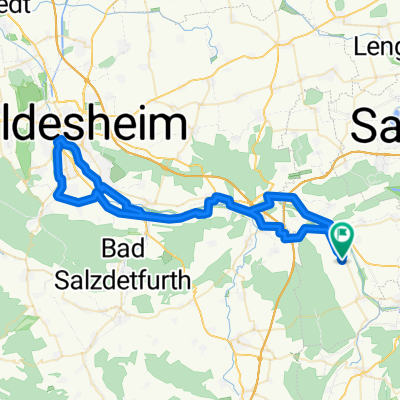
Steinlah Mühle - Heere
A cycling route starting in Heere, Lower Saxony, Germany.
Overview
About this route
Feieraberd Route - Heere, Klein-Elbe Feldweg zur Mühle, Haverlah, Ringelheim,Alt Wallmoden, Heere.
- 2 h 1 min
- Duration
- 24.2 km
- Distance
- 99 m
- Ascent
- 101 m
- Descent
- 12.1 km/h
- Avg. speed
- ---
- Avg. speed

Route quality
Waytypes & surfaces along the route
Waytypes
Quiet road
11.3 km
(47 %)
Road
4.8 km
(20 %)
Surfaces
Paved
5.8 km
(24 %)
Unpaved
0.5 km
(2 %)
Asphalt
3.3 km
(13 %)
Paved (undefined)
2.2 km
(9 %)
Continue with Bikemap
Use, edit, or download this cycling route
You would like to ride Steinlah Mühle - Heere or customize it for your own trip? Here is what you can do with this Bikemap route:
Free features
- Save this route as favorite or in collections
- Copy & plan your own version of this route
- Sync your route with Garmin or Wahoo
Premium features
Free trial for 3 days, or one-time payment. More about Bikemap Premium.
- Navigate this route on iOS & Android
- Export a GPX / KML file of this route
- Create your custom printout (try it for free)
- Download this route for offline navigation
Discover more Premium features.
Get Bikemap PremiumFrom our community
Other popular routes starting in Heere
 Grasdorf-Hockeln-Marienburg-Ochtersum-Söhre-Heersum-Holle-Heere03.05.2017.gpx
- Distance
- 65.9 km
- Ascent
- 178 m
- Descent
- 179 m
- Location
- Heere, Lower Saxony, Germany
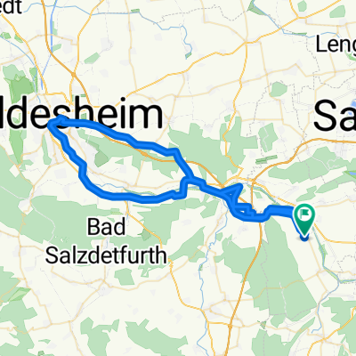
 Mühle Steinlah
- Distance
- 31.8 km
- Ascent
- 105 m
- Descent
- 106 m
- Location
- Heere, Lower Saxony, Germany
 Oelber--Lichtenberg-Söhlde-Nettlingen-Holle-Heere07.02.2017.gpx
- Distance
- 54.4 km
- Ascent
- 287 m
- Descent
- 290 m
- Location
- Heere, Lower Saxony, Germany
 Lafferde
- Distance
- 65.1 km
- Ascent
- 230 m
- Descent
- 230 m
- Location
- Heere, Lower Saxony, Germany
 Sehlde-Sz.Bad-Ohlendorf-Gielde-Liebenburg-SZ.Ringelheim-Heere11.04.2017.gpx
- Distance
- 54.2 km
- Ascent
- 163 m
- Descent
- 161 m
- Location
- Heere, Lower Saxony, Germany
 Heere-Holle-Heersum-Kl.Düngen-Hildesheim-Uppen-Wendhausen-Holle-Heere04.04.2017.gpx
- Distance
- 61.9 km
- Ascent
- 248 m
- Descent
- 251 m
- Location
- Heere, Lower Saxony, Germany
 Holle-Luttrum-SZ.Lesse-Osterlinde-Wartjenstedt-Heere31.01.2017.gpx
- Distance
- 45.2 km
- Ascent
- 150 m
- Descent
- 150 m
- Location
- Heere, Lower Saxony, Germany
 Franzosenbrücke über Gitter,Haverlah,Klein Elbe.
- Distance
- 26.4 km
- Ascent
- 98 m
- Descent
- 97 m
- Location
- Heere, Lower Saxony, Germany
Open it in the app