
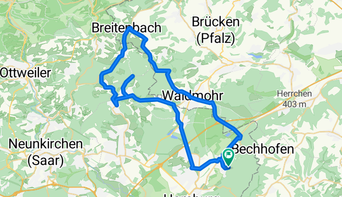

Auf in die Pfalz 2007 - RTF des RSC Endspurt Sanddorf e.V. 1970 - 152 km Strecke
- 148.1 km
- 1,404 m
- 1,388 m
- Bechhofen, Rhineland-Palatinate, Germany
Sanddorf Erbach Jägersburg Höchen Höcherberg up to the tower, then down to the right to Frankenholz, then right to Remmersfürth Lautenbach. In Breitenbach, up to Bambergerhof. Over Waldziegelhütte steeply down to Waldmohr towards the highway connection A6 on the B40 towards Bruchhof and Sanddorf. Elevations: about 5 km uphill from Jägersburg to the Höcher tower and about 3 km from Breitenbach to Bambergerhof. Thus, training mountain stage!
Road
7.2 km17 %Quiet road
6 km14 %Paved
31.5 km(74 %)Unpaved
3 km(7 %)Asphalt
30.2 km71 %Gravel
1.7 km4 %Free trial for 3 days, or one-time payment. More about Bikemap Premium.
Discover more Premium features.
Get Bikemap PremiumOpen it in the app


